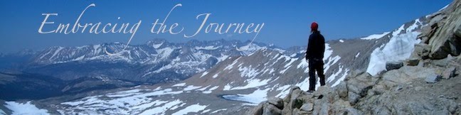
The approach to Forester was still partially snow covered, so the trail was easy to lose as it wound in and out of snow patches. We just decided to head for the pass and pick up the trail when we got to the switchbacks at the base of the rock face. Our feet were soaking wet from the combo of walking on melting snow and the fact that we had our first creek fords earlier that day. We had finally hit some creeks with no logs to cross over. We just had to suck it up and walk on through the chilly, snow-melt water.
We had a funny moment when another hiker (who was following a little bit of intuition and a little bit of other hikers footsteps) was headed toward a canyon that looked like it should have been our pass; all of a sudden he hears someone shout from a distance, "You're going the wrong way!!" He looks around, sees us, and heads our direction, thinking it was us. He was dumbfounded to hear that it was a couple hikers who were already on top of the pass and to see where we were really headed.
The switchbacks weren't melted out at the bottom yet, so we climbed up half snow fields and half rock patches until we found dry trail to follow to the top. There is one snow finger at the top of the pass that doesn't melt out until much later in the season, and it is a very steep, so we got to pull out our ice axes for the first time (and a total of maybe 10 steps). Luckily there were already good footsteps kicked in from hikers who had gone before us, and the sun was shining in the snow, making it softer and easier to walk across.
We stood on top, took in the views, and looked down to the north side of the pass, which had much more snow than the side we had come up. We kept our ice axes out for the first part of the descent, but son put them away as the terrain became gentler and the trail was easier to spot. We got to glissade down a very short section of snow (sliding down on your butt), which was fun.
Regardless, the trek away from forester was a wet slog between muddy trail and melting snow, and we soon came to terms with the fact that our feet would just be wet.
We camped at a trail junction with several other hikers who were all, along with us, headed out a side trail up and over Kearsarge Pass and into town to resupply the folowing day.
Total Miles:789.5
Miles Today:20.7
Camp 44:Bullfrog Lakes Jct (Kearsarge)
------------------------------
Refer-A-Friend to PocketMail today and a receive $50 in service or $25 in CASH!

1 comment:
Ahhhhhhhhhhhh I can watch every switchback in my mind up that shear wall trail... right down to the final tiny switchbacks at the top after crossing the "snow finger"--glad you go to do it Northbound this time!!! --coach d
Post a Comment