Thursday, June 26, 2008

June 24:1000 Miles!!

We busted a move out of our mosquito-ridden camp and headed downhill toward our creek crossing. I ended up keeping the headnet on for a good chunk of the day because the first 10 miles or so were fairly flat (a great relief from the intense climbs of the day before), but the flatness walked us through meadow after meadow (read:mosquito after mosquito).

We soon ran into another hiker, Sarong, who we had been leap-frogging with for a couple days, and ended up hiking with him for the rest of the day.

Two things were significant about today: 1. We left Yosemite, which also means the terrain leveled out a bit, and 2. We passed the thousand mile mark on our trek!

I remember back when we started, thinking that 1000 miles seemed so far away, and yet here we are. It's crazy to have hiked this far and not even be half way yet!

So we headed over Dorothy Lake Pass, which officially led us out of Yosemite, and began what would be our last climb up to higher altitudes (10,880 ft). We crossed the 1000 mile mark and someone had put a rock line across the trail and spelled out in rocks "1000." So we took a few pictures, swated at a few mosquitos, and rolled on toward higher ground.

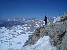
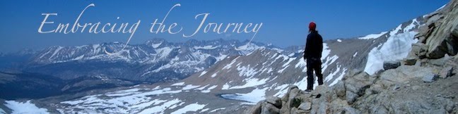
Evenually the trees gave way to gravelly, snow-patched mountains, and we climbed up onto a ridge that offered great views of the surrounding peaks (although they were a bit hazy due to the fires that are raging somewhere in Northern Cali. We don't see fire, but we sure are getting the smokey haze).

We climbed up to 10,640 ft and made ouselves a camp on a very rocky mountainside. We tossed aside the bigger rocks, smoothed and leveled the gravel, and fell asleep thankful: 1.we had sleeping pads to cushion us from the rocks,
2.there were no mosquitos, and
3.we only had 5.8 miles left to walk with the extra weight of bear canisters and ice axes.

Tomorrow, Sonora Pass...

Total Miles:1012.5
Miles Today:27.1
Camp 58:Rocky Ridge with Sarong

------------------------------
Refer-A-Friend to PocketMail today and a receive $50 in service or $25 in CASH!

June 23:Canyons and Mosquitos

We woke up in the meadow with frost on our tarp and bear canisters, and everything else was just damp. It was chilly out, and our first task of the day was to climb 1000 ft and walk through several creeks on the way. Luckily we are used to wet feet by now and the sun quickly rewarms you after the initial shock of cold as you step into the creek.

It was a hard day all around. We spent the day going straight down into a canyon, crossing a creek, and then climbing straight back up the other side. We did this about 4 times. We worked our butts off, and at the end of the day we had only done 22 miles (with the effort of 27 miles).

To top it off, we were almost constantly in mosquitos. With snowmelt, everything is wet and a prime breeding ground for the little buggers. You have anywhere from 30 seconds to 2 minutes when you stop walking before they find you. So if you have to go to the bathroom, you throw off your pack and go as fast as you can so you can start walking again. If you want to take a break you either wear your "mosquito armor" (see previous post) or wait a few seconds to see how many are around. I must say that I have gotten good at shoveling food under my headnet and into my mouth. Luckily today we were able to find a breezy spot for a break that kept them at bay. It was very refreshing. We definitely weren't so lucky with our campsite. They swarmed us as we got the tarp set up, but luckily once inside, we only had a few to deal with, although we did sleep with our headnets on.

Many would read this and say, "And this is supposed to be fun?!" Well, yes...and no. Long-distance hiking is a lot like life; some days are better than others. Some days you love it so much you can't wait for the next and others you want to be at home watching TV. But you just keep going because it's a journey you've chosen to be on and most of the time it's amazing. And that's what you hold onto when mosquitos are swarming your head as you try to eat or sleep and you remember that tomorrow is a new day to look forward to and a new leg of the journey.

Total Miles:985.4
Miles Today:22.0
Camp 57: Mosquito Raid

------------------------------
Tell your friend about PocketMail and let the savings start rolling in!

June 22:Yosemite Wilderness

We had initially planned on getting up and leaving Tuolumne early like a normal day of hiking, but we decided last minute to stay until a store opened so we could buy some more DEET. We were almost out and we heard that there were mucho mosquitos north of Tuolumne. In the meantime, we found out that there was a "free coffee/tea with the rangers" at 8am in a campfire circle near our campsite. So we headed over there to wait for the store to open at 9am. We also saw a sign the night before saying that the store had free coffee at 9am, so we got more there as well! Must be a Sunday morning thing.

We finally rolled out around 10:15am after drinking a few cups of coffee and hanging out with a few hikers we'd been hiking with for awhile.

The terrain changed dramatically in this part of the Sierra. There are now very steep canyons with a creek flowing at the bottom, and we just go from one to another...straight up and straight down in thousand foot incriments. It is very challenging terrain, but also very beautiful. It is also very mosquito-y as well since we are at lower elevations now. We ended up camping in a meadow, where I donned my "mosquito armor," which consists of my rain pants, windahirt, gloves, and headnet, before setting up our tarp. In this getup I am bug-proof :). It's a beautiul thing. Luckily once we set up our tarp they weren't bright enough to find their way in so we had a peaceful nights sleep.

Total miles:963.4
Miles Today:20.7
Camp 56:Frosty Meadow

------------------------------
Allow us to help those in need, sell back your spare PocketMail and make some extra pocket money.

June 21:Tuolomne Meadows (aka:RAIN!!)

We were camped with JZ at Thousand Island Lake. He is an early riser anyway, usually pulling out of camp before we wake up; this morning he was going to leave with us, but get up early to take some pictures of the sunrise over the lake (he has a really nice camera that takes great pics). We heard him get up, so Mark hopped out of his sleeping bag and went to take some pictures as well, while I had a relaxing morning packing up and eating breakfast in the tarp.

We headed up and over Island Pass, which is barely a pass at all because if you didn't know what to look for, you wouldn't even know you were at the top. Then our next goal was Donahue Pass, which sits just over 11,000 ft and would be the last time we were at that height for the remainder of our hike. It is a long, gradual, snow-patchy slog up to Donahue, but we made it, taking a nice break at the top. The other cool thing about Donahue Pass is that once you go over it, you are in Yosemite Wilderness, which is very beautiful and is known for it's bear issues.

We had heard that Tuolomne Meadows, our ultimate destination for the day, had a little restaurant, and we were very excited about getting another hot meal (I was craving a chicken sandwich). This spurred us on as we descended Donahue and headed down through Lyell Canyon passed all the JMTers and weekend hikers (there were LOTS!).

As we walked, we noticed that the sky was filling up with fluffy white clouds. Later, there were a few darker ones, and we even got a sprinkle or two- nothing too serious. We continued on, and as we neared Tuolomne, the clouds were much darker, and we began to walk faster, hoping to make it to the restaurant/store before it let loose. Once we heard thunder we knew we were doomed, so we pulled out our rain jackets just as the heavens opened up; we were less than a mile to our destination.

We arrived at the restaurant and store area soaking wet only to find out that the restaurant closed at 5pm. Unfortunately for us it was 5:01 and they pointed to the people in front of Mark and said "They are the last ones." Not only did we get rained on, but we didn't even get a chicken sandwich. It was sad. To compensate, we went into the store and got a frozen burrito that we could heat up in the microwave, and JZ got some hot dogs. We waited for the rain to let up and headed to the backpackers camping area where we made a campfire and roasted our hot dogs. It ended up being really nice.

Since Tuolomne is just 20 trail miles from Yosemite Valley, the bears are very active. Everything goes in your bear box at the campsite. Luckily we had none, but I do have faint memories of hearing a car horn in the middle of the night and finding out a bear broke into someone's car! Crazy. Luckily we are carless this summer :).

Total Miles:942.7
Miles Today:20.1
Camp 54:Tuolomne Meadows Backpacker Campground

------------------------------
Have a spare PocketMail laying around, sell it back to us and help those in need.

June 20:Red's Meadow

We had camped 11 miles short of Red's Meadow, a mountain resort (again, not glitzy) that caters to Equestrians and that markets itself as a premier back-country campground for Mammoth Lakes. They also offer free hot spring showers and cheeseburgers (not free). It was the latter that drew us in. With 11 miles to go, we would roll in for an early lunch, which is what we did. I was starting to feel like I had way too much food with me, since we'd had a hot breakfast at VVR the day before and then a hot lunch here at Red's. We passed on the hot spring showers, as tempting as they were, mostly because of time and also because we would have to hike to the campground to find them. You know you've been hiking awhile when you say things like, "I don't need a shower; I just took one two days ago."

We hiked on...and on and on. Our goal was Thousand Island Lake, 15ish miles passed Red's. After taking two hours off around lunch time, that is a big day. Most of that hike was a totally new section for us. Through the High Sierra we follow the John Muir Trail, but there is about 14 miles where they split, and you have the choice to follow the JMT or the PCT. Since we had done the JMT section last time, we kept on the PCT, which gave us some great views, especially toward the end of the day.

The trails reconnect at Thousand Island Lake, which is where we set up camp and finished one of the longest days we've hiked yet.

Total Miles:922.6
Miles Today:26.8
Camp 54:Thousand Island Lake

------------------------------
Tell your friend about PocketMail and let the savings start rolling in!

Saturday, June 21, 2008

June 19:Silver Pass

We woke up early, mostly because we can't sleep in anymore. We also wanted to eat a good breakfast and be packed up and ready to go for the first morning ferry. They still hadn't gotten the pontoon ferry working yet so the shuttle was still small fishing boats that only hold 4 people. The day before they had done an extra early run, and we were hoping we could be on one this morning if one went. We ate our 5th and final meal at VVR (pancakes), paid the tab we'd been running (yikes!), and were able to get shuttled out on an 8am run.

This would be a day of verticle feet. We left VVR and began our climb up to Silver Pass, which was a 3000 ft climb. The other side still had a lot of snow so we got to glissade (slide on our butt) down two different sections (I always recommend pants for this or you will have lots of snow up your shorts).

We climbed down for awhile, then back up 1200 ft to the stunningly beautiful, postcard-perfect Virginia Lake. Next a descent and then 600 more ft up to Purple Lake. Add in all the other little ups and downs and we had climbed around 5000 ft. Luckily we had all that good VVR food in us to give us energy!

We camped a bit early because we were descending, and that can quickly equal mosquitos. We found a great campsite with a fire ring, and made the first fire of the hike with our friend JZ. He even let us use his extra fuel to heat up some water to make soup (we'd gotten them out of the hiker box @ VVR), so we had a little bit of hot food too!

Total Miles:895.8
Miles Today:18.6 (+1.5 from Ferry)
Camp 53:Campfire With JZ

------------------------------
Allow us to help those in need, sell back your spare PocketMail and make some extra pocket money.

Friday, June 20, 2008

Bonus:Desert Reflections

These will be random personal notes for myself on hiking the desert section.

Gear notes:
Platypus worked great, no punctures from prickly bushes.
It can get below freezing at night... be prepared.
Have Rain gear. Snow, hail, rain, anything is possible. Don't be foolish.
Have some type of shelter even though you may rarely set it up.
Thin gloves were great!
Gaiters were very nice to keep rocks and junk out of shoes.
Breathable shoes are a trade off because they let dirt through the mesh. It's a personal choice. Anything could work.
Big hat was very nice. Have a string.
Be ready to carry lots of water.
Pants are nice for warmth, but probably not needed for sun protection. Sunscreen will help dirt stick to the legs and protect you. Pants vs shorts is personal preference.
Sunglasses are very nice.
Light colors didn't seem to be much cooler and they are way dirtier looking.
Have sunscreen for face and maybe arms.
Deet is not needed. There were a couple places with a few mosquitos, but just don't camp there.
Jess liked baby wipes for cleaning dirt off her face.
I carried a short sleeve shirt, a long sleeve, a Marmot windshirt, a rain jacket. This seemed pretty good for me.
I had rain pants as well as another lightweight breathable part of the time. Ditched the rainpant for a while. Picked it up again after the snow storm. I did not carry long underwear. 1 or 2 layers of some type
for your legs would be fine.


It is very windy often.
It is dry and dusty.
Many people had dry throats. Cough drops or other hard candy is great to have.
It's usually not really that hot. You can often hike in the afternoon just fine.
Only if you really get a heat wave would I think of taking the 1pm to 4pm break.
Night hiking is definetly an option, but carry a decent headlamp if you plan to do it much. You could also just walk right up until dark.
Big miles are totally possible... 25-30 miles per day could certainly be done if you manage your time.
Obsticals to big mileage average would possible heat wave, carrying extra water weight, and just not managing ones time and breaks.

Rattlesnakes are around, you may see a few- just be alert. They usually give warning and are not immediately aggressive. Hiking poles may give some comfort for probing ahead as you walk.

There is more shade than I expected. Maybe only a few times was I not able to take a break in the shade. there may not be much shade, but you only need one spot every couple of hours.

The mountains are big at times. You will do climbing, and you will have a surprising amount of pine trees.

I drank more water when climbing, and the most when climbing in afternoon heat.
Stay hydrated in town, it's easy not to drink when your not exercising.

The desert is beautiful!

The water sources vary year to year.
Don't miss a water source- be aware. If it's more than a quarter mile off trail consider going without.

------------------------------
Tell your friend about PocketMail and let the savings start rolling in!

June 18:Vermillion Valley Resort

The word "resort" may be a little bit of a stretch. VVR is a resort in the sense that it is a get-away place in the mountains, has a restaurant, and offers fun things to do (if you like to fish, kayak, hike, etc). But don't get a picture in your mind of a ritzy resort; it's definitely not that.

VVR has a handful of rooms to rent, but most hikers either camp or stay in the platform tents that have very basic (yet surpringly comfortable) beds in them. Your first night is free, which is cool, and you will definitely eat well here.

We didn't know if we would stay one night or two; VVR runs their shuttle once in the morning and once in the afternoon, so we thought we might go out on the afternoon ferry and camp a few miles down trail. Needless to say, once the time was drawing near for the shuttle, we decided to stay a second night. We had 3-4 stream crossings to do in the first 4 miles, and we decided to save them for the morning instead of doing them right before bed. We were each also reading a book on Denali that we found lying around (different ones), and we had a relaxing afternoon of doing absolutely nothing except for reading and lying around resting. It's easy for our zero days to feel busy normally because we are going to the grocery store, mailing stuff, etc. This was pure rest. And we ate amazingly as well. Mark and I both finished our books in the evening, and fell asleep in our sleeping bags, but, yes, on a bed. Delightful.

Total Miles:877.2
Miles Today:0
Camp 52:VVR

June 17:Seldon Pass & VVR

Seldon Pass has been called by some "the easiest pass," and thus far, I wouldn't disagree. We had 3.9 miles to the top and only 800 or so feet to climb, making our morning climb fairly gentle. Our goal was to make it the 17.2 miles to the trail junction to Vermillion Valley Resort, then walk the 1.4 mile side trail to Lake Edison to catch the ferry boat acros the lake.

It didn't take long befoe we were standing on top of the 10,900 ft pass. The descent was snowy, but gentle, passing from snow to trail and back again.

A few miles later we crossed Bear Creek. In '05, this was the scariest creek crossing we had. Crossing it at the trail wasn't an option; we had to go downstream a bit to where it forked into three branches and melowed out a bit. This year, all our stream crossings have been much lower than in '05, so I was hoping that this one would be managable as well. And it was. It was definitely one of our deepest fords, with water at the mid-thigh, but it was managable, even at the trail crossing.

We hiked down through some meadows, not pausing for long unless we were sure the mosquitos weren't really around.

The only deterrent from our descent was a 900 ft climb up Bear Ridge, which wasn't bad compared to the 2000 ft descent down the countless switchbacks that led us to the trail junction that led us to the VVR shuttle.

We walked up to the lake, in awe of what we were seeing. JZ had mentioned that last Sept the lake had been so low he'd had to hike an extra 2 miles to catch the ferry. We didn't have to walk that far, but we did have to walk at least a quarter of a mile down what is usually the bottom of the lake in order to get to the ferry pick-up. The guy who picked us up (in a small fishing boat instead of the bigger ferry boat) told us that he thought the lake was at 40% of what it could be. At the other end of the ride, we hopped into the back of a truck and drove even farther over what is normally lakebed to VVR and a fantastic hot meal. As an added bonus, we got to watch the Celtics kill the Lakers in the NBA Finals' last game. Perfect timing...hot meal, basketball game , other hiker friends, and a bed. It was definitely worth the extra effort to get in early!

Total Miles:877.2
Miles Today:17.2 (+1.5 to shuttle)
Camp 51:VVR

------------------------------
Refer-A-Friend to PocketMail today and a receive $50 in service or $25 in CASH!

June 16:Muir Pass

We started our morning hike just as another hiker JZ caught up to us. JZ has hiked the triple crown, all 3 of America's major trails. He hiked the AT in 76 and the PCT in 77. He again hiked the PCT in 2000 and finished the triple crown with the CDT in 2002. We've been hiking with him these last few days in the Sierra and enjoyed hearing about his past trips.

From our lake at about 10,800 ft, we walked snow all the way up toward the top of Muir Pass. Muir is a long, fairly gradual pass, so it was nice to be on frozen, firm morning snow. We actually were suprised to find a few pieces of trail melted out on the way up and around Helen Lake. We reached the top of the pass by 8:15am. The top of the Pass has a stone emergency hut, but on this georgeous morning we sat outside.

We walked snow until around Saphire Lake, where we started to get trail. Evolution Lake was totally melted out which surprised us. More Lakes have been frozen than we remembered in 2005. Being earlier in the year the temps have remained cold at night, but '05 had more snow. This was our first sign of more melting than we had on our JMT hike.

We crossed Evolution Creek right at the trail at about knee height, just getting the tips of our shorts wet. We were happy at how mild this notorious crossing was. We continued to decend and decend most of the day. As we neared the trail break for Muir Trail Ranch the mosquitos began to get after us and our speed increased. We began to climb up a hillside at a vigerous speed. We had to stop for water and broke out the mircle drug: DEET. A few squirts brought great relief from the bugs. It's amazing how well it works.

We were stuck climbing up a set of steep switchbacks before we could find anywhere to sleep. Finially with sun set and dimming we reached a nice flat spot just before a stream crossing, and crashed after what turned out to be a pretty big day.

Total Miles:860.0
Miles Today:25.0
Camp 50:Below Seldon

------------------------------
Tell your friend about PocketMail and let the savings start rolling in!

June 15:Mather Pass

Camping just below 11,000 ft we expected a colder night. It seems our sleping bags are doing their job and sleping under our Black Diamond tarp is adding some warmth. We walked between patches of snow and rock toward Mather Pass. We even followed patches of trail. We could see the pass as we walked closer and could tell the upper switchbacks were totally covered in snow. This side of Mather has a rather steep face and is exciting or pee your pants scary depending on your perspective. We followed the line of the trail around to the snow covered switchbacks. A solid set of foot prints were kicked in the snow that went up quickly at a slight angle and only made one switch back the other direction before reaching a piece of trail at the top. One switchback in the snow where the buried trail may have 5 or 6. We grabbed our ice axes and headed up the steep foot prints. We both moved a steady pace with Jesica a bit slower. The sun was on us at just after 8am and we becam!
e very hot. Still minutes later we found ourselves a top the gargantuan pass. It had only taken an hour and a half from our campsite, but a lot of energy.

We cruzed down the other side of the pass with some steep beginings in snow and rock. We walked mostly snow with some rock patches and then mostly rock with some snow patches. We found the trail as we got near to the lakes below the pass. It's incredibly beautiful here, like maybe the most beautiful place in America.

We continued to pound down and down our massive decent until hitting a river which we luckily this time we did not have to cross, but turned and walked along side as we climbed up and up.

There are some incredible meadows along the climb up. You could spend a day in any one of them basking in the beauty. We had considered climbing very high, even going all the way to the top of the pass where there is an emergency hut we could have slept in. But, right when significant snow walking hit we came to a large lake still mostly frozen around 10,800 ft. We decided to take the picturesce campsite along the lake. Although, my pictures don't come close to capturing the magnitude and beauty.

Total Miles:835.0
MILes Today:20.5
Camp 49:Below Muir

------------------------------
Allow us to help those in need, sell back your spare PocketMail and make some extra pocket money.

June 14:Pinchot Pass

Our day started with a descent of about 1500 ft. We were headed down to cross a creek, like you do after every big pass you go over (actually, you cross tons of little creeks and tributaries along the way as well). When we finally made it down to Woods Creek, we were delighted to find a suspension bridge spanning the roaring river. Our feet would stay dry! For now.

Our goal was Pinchot Pass (12,130 ft). I remembered this pass as being a fairly gradual one, and it was; but the approach was covered in patches of snow and so the climb took a bit longer due to the navigation. Eventually we were on top and we took a break on top to refuel and rest for the journey down (and then back up).

Normally we drop down 3-4000 ft after a pass to cross a creek (think small river), but we only dropped down 2000 this time, so the climb up to get ourselves ready for Mather Pass the next day had the potential to be an easy one...except that we had to ford a ton of creeks.

Some had logs or rocks to help us across. Others we had to walk through frigid water, usually no deeper than our knees (although my shorts did get wet in one ford).

There was one ford that was more like a raging river when we walked up to it, but luckily it forked into three branches that made it easier (not less scary) to cross. Luckily it looked worse than it was, and we made it to camp safe and sound, albeit with wet feet.

Total Miles:814.5
Miles Today:17.1
Camp 48:Below Mather

------------------------------
Have a spare PocketMail laying around, sell it back to us and help those in need.

June 13:Kearsarge Pass & Glen Pass

We woke up earlier than we would have on the trail. We had to catch a 7am bus back to Independence and then hitch back up to the trailhead. There were 5 of us, which always makes hitching harder (on top of the fact that we were hitching to a dead end road). We were there for almost an hour and a half before a guy drove by, said he could take 2 of us and would come back for the rest.

The climb out over Kearsage is 2500 ft, but wasn't as bad as we expected because the ascent is so gentle. Soon we were standing on top of Kearsarge Pass for the second time. I am thankful that most passes we climb over we only have to do once!

We hadn't planned on going over Glen Pass today, but we were on top of Kearsarge by noon, and the passes are only 5 miles apart. We had also heard that Glen could be icy and that it would be better to do it in the afternoon when the snow is soft. So we headed up and over Glen as well.
It is fun going over these passes and remembering them from when we hiked the John Muir Trail in 2005- only this time we are going the opposite direction (we hiked the JMT southbound).

The descent down Glen was steep and snowy, but with the soft snow we were able to climb down no problem. After a few more miles of hiking we found one of the only grassy spots among a canyon of rocks, pitched our tarp, and fell asleep, ready for rest.

Total Miles797.4
Miles Today:7.9 (+7.1 Kearsarge miles)
Camp 47:Grassy Patch

------------------------------
Tell your friend about PocketMail and let the savings start rolling in!

June 12:Bishop, CA

We took another zero day today mostly because we had to work so hard to get to Bishop (go over Kearsarge Pass, hitch 41 miles) that we thought we should take a day off before we had to reverse the whole process to get back to the trail.

We spent the day running errands and relaxing. We hit up the post office the day before (and got a great pkg from my parents! Thanks!), and today we had to run to the local outfitter (sells outdoor gear), grocery store, and post office again to resend our bounce box. I always hate having to put my flip flops back in the box and wear my hiking shoes around town, but alas, it was only for a couple of hours. I also got to stop into the local coffee shop for a latte...mmmyum.

We decided to grill out again with the hiker crew who were still at the hotel and had another amazing meal. Why does everything taste better on the grill? Chicken, steak, zucchini, potatoes, hot dogs/cheddarwurst were shared among us. It was a feast.

Mark watched the end of the basketball game (lakers vs celtics) and was estatic because Boston won. Biggest comeback in NBA finals history. Woohoo!

Nothing too crazy, but a great day nonetheless and a great group to spend it with!

Total Miles:789.5
Miles Today:0
Camp 46:Bishop- Village Motel

------------------------------
Allow us to help those in need, sell back your spare PocketMail and make some extra pocket money.

Friday, June 13, 2008

June 11:Kearsarge Pass

Kearsarge Pass is probably the most work off the PCT we will have to do to resupply in town. It's only 7 miles extra one way, but you go up and over a spectacular pass. We chose this as a resupply because we heard it was beautiful and we had not hiked over the pass while on the JMT.
We started with our usual morning and hiked out the Bullfrog Lake trail. We were rewarded with picturesque views of lakes and the towering Kearsarge Pinnicles. There was very little snow on the way up to the pass and in an hour and fifteen minutes we stood on top of the pass. After some snacks and pictures we started our cruise down. Every step down we realized would represent a step we would have to take back up. And the 2,500 ft back up would be with heavy packs loaded with a new load of food.
We cruised to the trailhead with 5 other hikers all looking for a ride down to town. There was not much traffic since we were at the end of the road. We lucked out after about 20 min when a guy preparing to hike the JMT was willing to give us a ride. All of us. And his Forerunner was already packed full of gear and other stuff. Jess and I were in the front seat along with a third hiker and the driver. Packs were loosly straped on top and 3 other hikers smashed in the back with tailgate up. It wasn't the safest drive for ourselves or packs on top, but we would be able to roll rather slowly down the hill. It wasn't the most comfortable ride, but we were happy to be in Independence. We hit the Post office and Subway rather quick. Then because the grocery store was out of business and there not much there we made the choice to hitch down the road to Bishop 40 miles away. We luckily got a quick hitch from a young gal who was heading back home to Mammoth Lakes.

We stayed at the Village Motel with some other hikers. We scored a room with a kitchen, but the highlight of the night was the grill out front on a patch of lawn. A group of us all cooked out and our Chicken breast and Zucchini tasted amazing!

Total Miles:789.5
Miles Today:0 (+7.1 over Kearsarge)
Camp 45:Bishop,CA- Village Motel

June 10:Forester Pass

We had hoped to get closer to Forester Pass the day before we went over it. Forester is the highest point on the official PCT, topping out at 13,200 ft. Usually you can tell which is the pass you are heading for, but Forester is totally unassuming. As you get closer, you look up at this sheer rock face with a tiny notch at the top and think, "I have to go up THERE?! That COULD'T be the pass!" Oh, but it is. If we hadn't done the JMT a few years ago, I'm sure I would have been just as surprised as some of the other hikers we were with.

The approach to Forester was still partially snow covered, so the trail was easy to lose as it wound in and out of snow patches. We just decided to head for the pass and pick up the trail when we got to the switchbacks at the base of the rock face. Our feet were soaking wet from the combo of walking on melting snow and the fact that we had our first creek fords earlier that day. We had finally hit some creeks with no logs to cross over. We just had to suck it up and walk on through the chilly, snow-melt water.

We had a funny moment when another hiker (who was following a little bit of intuition and a little bit of other hikers footsteps) was headed toward a canyon that looked like it should have been our pass; all of a sudden he hears someone shout from a distance, "You're going the wrong way!!" He looks around, sees us, and heads our direction, thinking it was us. He was dumbfounded to hear that it was a couple hikers who were already on top of the pass and to see where we were really headed.

The switchbacks weren't melted out at the bottom yet, so we climbed up half snow fields and half rock patches until we found dry trail to follow to the top. There is one snow finger at the top of the pass that doesn't melt out until much later in the season, and it is a very steep, so we got to pull out our ice axes for the first time (and a total of maybe 10 steps). Luckily there were already good footsteps kicked in from hikers who had gone before us, and the sun was shining in the snow, making it softer and easier to walk across.

We stood on top, took in the views, and looked down to the north side of the pass, which had much more snow than the side we had come up. We kept our ice axes out for the first part of the descent, but son put them away as the terrain became gentler and the trail was easier to spot. We got to glissade down a very short section of snow (sliding down on your butt), which was fun.

Regardless, the trek away from forester was a wet slog between muddy trail and melting snow, and we soon came to terms with the fact that our feet would just be wet.

We camped at a trail junction with several other hikers who were all, along with us, headed out a side trail up and over Kearsarge Pass and into town to resupply the folowing day.

Total Miles:789.5
Miles Today:20.7
Camp 44:Bullfrog Lakes Jct (Kearsarge)

------------------------------
Refer-A-Friend to PocketMail today and a receive $50 in service or $25 in CASH!

June 9:Mt. Whitney

We woke up a little earlier today in order to begin our hike up Mt. Whitney. Last time we climbed this mountain we were able to camp about 2-3 miles and 1000 ft of elevation closer to the summit. This time, we had a few more miles to put in.

We decided to stash our sleeping bags, tarp and a few other unnecessary items so that our packs would be lighter for the climb. We also took only enough food for the day and stashed our heavy bear canisters as well.

We hiked up passed Timberline Lake and up to Guitar Lake (yes, it is shaped like a guitar!), where we took a break to gear up for the 3000 ft climb ahead.

There was a little snow to navigate through in order to get up to where the switchbacks took us up to the ridge where we would head up to the summit. As we climbed, we crossed several hikers coming down who had gotten an earlier start than we did. We also came across a few who had climbed up from Whitney Portal on the other side of the mountain. If we thought we had it bad having to climb 4000 ft to get to the summit, they had it far worse. The climb up from Whitney Portal is a grueling 9000 ft and something like 93 switchbacks. Many of those people looked very tired and thankful to be on their way down.

When we finally reached the summit we were very surprised that there were very few people up there. Later in the season the summit will be crawling with people, but there were never more than 10 people (including us) up there. For the last 10 minutes we were up there, it was only Mark and I! We took some pictures and enjoyed the beautiful views and weather. There was only a slight breeze, and we took a long break next to the hut that's up there with a couple other hikers who arrived just after us.

As we descended, we crossed a few more ragged climbers coming up from the Portal Side; at Guitar Lake and beyond we ran into TONS of hikers who were coming up to camp at the lake for their ascent the following day. There probably would have been 30 tents up there that night!

By the time we returned to our stuff, the day was coming to an end and we were tired. We knew we didn't have time to get far, but we wanted to walk a little farther in order to get closer to Forester Pass, which we would be doing the following day. We ended up sleeping in a sandy saddle, tired, but excited about what we had accomplished.

Total Miles:768.8
Miles Today:1.7 (+17 Mt Whitney Miles)
Camp 43:Sandy Saddle

------------------------------
Tell your friend about PocketMail and let the savings start rolling in!

June 8: The Sound of Water

Today was the first time we really began to see day hikers. This was probably related to crossing into our first national park, Sequoia National Park. We continued to be surprised how little snow there seemed to be, but again this was all in perspective of our 2005 hike in this area. Having good trail allowed us to keep a pretty normal pace even though we were gaining and loosing elevation. We expected our mileage to drop a bit more than it has.

It has been really great to have so much water around us. I never have to carry more than 1 liter, with a little planning. The sound of running water is so exhilerating to have in the mountains. In the desert we had forgotten just how sweet it is. We have also begun crossing creeks quite a bit today. So far we have not had to get our feet wet; there have been rocks and logs that you can acrobatically use to get across. We know our feet won't stay dry forever as their will be much bigger and raging waters ahead. All the melting snow has to go somewhere.

We have beem debating wether to do the side hike up Mt. Whitney, the highest point in the lower 48 states. We climbed this in 2005, finishing the John Muir Trail. It seemed other hikers who had done it in the past were not doing it again. It takes a full day to do the side trip and bonus 4,000 ft elevation. We had the time and the food, so in the end we decided we would do it again. We ended up camping at a trail junction near Crabtree Meadows.

Total Miles: 767.1
Today's milage: 23.1
Camp 42: JMT reconnect


------------------------------
Allow us to help those in need, sell back your spare PocketMail and make some extra pocket money.

June 7:Snow and a Bear

Fairly normal day in most respects. We went over (well onto) Cottonwood Pass in the morning. It wa our first shot at being over 11,000 ft, and someone had told us that Cottonwood would be a good judge of snow levels in the Sierras. We were more than surprised to find very little snow up high. Cottonwood was completely melted out, and there were only small snow patches elsewhere. Even though we knew there would be snow on some of the bigger passes we would go over, this was good news.

Toward the end of our day we stopped to get water. The spring was a short ways off the trail and Mark volunteered to go and get some for us while I stayed with our stuff. Shortly after he left I was looking around and glanced down toward the meadow near the spring where Mark went to get water only to see a bear. He was just in the opening between two trees, and still quite a distance away. My first thought was, "I'm not entirely sure where Mark went"; my second was, "I bet he's taking pictures." I then spent the rest of the next few minutes until Mark appeared sending the bear the vibe, "stay down there. stay down there." As son as Mark returned we hi-tailed it to higher ground to camp; and, yes, Mark did get a picture!

Total Miles:744.0
Miles Today:22.7
Camp 41:Mulkey Get Pass(t) the Bear

------------------------------
Have a spare PocketMail laying around, sell it back to us and help those in need.

June 6:Into the High Sierras

We knew we wanted to head out of KM sometime today, but we weren't sure what time exactly. We got up close to our usual time, but took our time getting organized. We debated about staying around for a cheeseburger @ 11am (they were incredible the day before!), but decided against it and were on the trail a little before 11am.

It was a long, hot climb out of KM. The first few miles were very much similar to the desert, and as we were walking we had our 5th encounter with a rattlesnake. We were just walking along, minding our own business, when we got rattled at from the side of the trail. He was about two feet off the side of the trail in the shadows of a tree. We wouldn't even have noticed him if he hadn't rattled, but for some reason he was all jazzed up; we took a picture and kept on going, leaving him to his lazy day in the shade.

We knew that there had been a fire just north of KM, and there had been a lot of rumors as to what that meant for thru-hikers. We'd heard at KM that the trail was open, the fire was contained, and if we saw any fire-fighters wrapping things up to just wave at them so that they knew you were around. When we got to that section of trail, it was crazy! I've never been in a recently burned area, but it was nuts! Everything was scorched, and we could even see some smoke rising from an area that was still smoldering. We really had the feeling lke we weren't supposed to be there, but when we waved at fire-fighters, they waved back and kept on doing their thing. Later we ran into some fire-fighters along the trail and found out it was a lightning fire, and since it's natural causes, they just let it do it's thing. If it were to spark up again, they'd let it run it's course, provided it didn't head toward people. We thanked him for letting us walk through and not have to skip a secti!
on of trail, and his reply was, "Oh this is the one trail we'd never close. Even if we had to fairy hikers through, we'd do it." What a cool attitude to have! It's always neat to see people excited about the trail and care about the journey we're on.

We headed on and up, through meadows and over rivers, finally ending our day around 9000 ft.

Total Miles:721.3
Miles Today:18.5
Camp 40:Tarp Next to a Pine Tree

------------------------------
Tell your friend about PocketMail and let the savings start rolling in!

June 5: Kennedy Meadows

We saved ourselves a nice little morning walk of less than 2 hours. On the way in we got our glimpse of the South Fork Kern River, the most water we have seen yet. In most places it was probably about 10 ft wide and a few feet deep. By many stardards it was not large, but this was our sign that we were leaving the desert for good and heading to bigger mountains and higher country.

We arrived at the paved road and got a lift the 0.7 mile down to the Kennedy Meadows General store. It was still before 9am so they weren't quite open. We went and pitched our tarp to claim some sleeping space, as around 40 hikers were probably staying the night tonight. This is a place probably every thru-hiker stops. Many years hikers end up taking multiple days off here waiting for snow to melt in the High Sierra Mountains just before us.

At the store we grabbed some huge muffins and an ice cream cookie sandwich. We collected our mail which included 2 bear canisters for food storage, our ice axes (packaged exceptionally well by Chad), a box of food we mailed from Agua Dulce, and a box of goodies from my folks. We paid $2 a box for them storing it, but my grandma's letter and a post card were free. It was fun getting all the mail, but we also knew our packs would be heavier with our ice axes and a 2.5 lb bear canister which is required in the upcoming national parks.

The store has a great porch to hang out on and chat with other hikers and is like what you would find at a campground. Well, a campground that is okay with having all kinds of junk and scrap metal laying around. They offered amazing double cheeseburgers at lunch! We enjoyed hot showers in the outdoor stalls and were able to do some laundry both for $2. We repackaged all our food and fit (smashed) it into the bear canister. I can probably get about 4-5 days food to fit. So, I have some other food to eat until I get to the required spot.

At dinner they offered a Lasagna meal for $8 and it came with a dessert which we enjoyed with about 25 other hikers. Just down the road from the store a guy has set up a satalite internet connection in a trailer and lets hikers use it for a donation. We enjoyed the community of other hikers and were excited to reach the end of the desert and be at a place that once seemed so far away.

That night we enjoyed a little concert by a hiker playing a backpacker guitar and another on a ucalaly (sp?).

Total Milage: 702.8
Today's milage: 5.7
Camp 39: K.M. General Store


------------------------------
Allow us to help those in need, sell back your spare PocketMail and make some extra pocket money.

Friday, June 06, 2008

June 4:Last Day in the "Desert"

So we're only sort of in the desert right now, but the way the trail is divided up we are technically still in the desert until Kennedy Meadows, and for us, that would be tomorrow morning.

We woke up damp with a low layer of clouds settling in over the mountains. I could see the trail go up and into the clouds and knew it would be a chilly morning. Luckily we would be climbing and, therefore, we'd heat up a lot quicker.

We walked for most of the morning in a swirling, foggy cloud; every so often the clouds would part and we would get spectacular views of the surrounding mountains. By noon the clouds had cleared and it was beautiful, clear skies all around.

We had one big climb left before Kennedy Meadows (KM), where we climbed up to what the data book called the "trail summit" @ 8020 ft, before descending into KM. We thought it would be a hot afternoon, but about halfway to the top we walked into an area that had burned awhile back and we got blasted by intense, make-it-hard-to-walk winds. There were constant strong winds, with gusts that tossed us around like rag dolls. We even had one gust that stopped us both in our tracks (PK, think Ranier). We eventually took a break in the least windy place we could find (which isn't saying much), and we heard a crack, only to look up in time to see a tree a ways away fall over from the force of the wind. Later, several other hikers reported seeing trees fall as well (and one guy almost got hit by one- twice!). We were really careful after that to keep an eye on the trees as we walked by to make sure they weren't swaying a little to much!

We went to sleep about 6 miles short of KM, leaving ourselves an easy walk in the morning and a relaxing day to look forward to (and a shower and laundry! WooHoo!).

Total Miles: 697.1
Miles Today:25.9
Camp 38:Last Night in the Desert

------------------------------
Have a spare PocketMail laying around, sell it back to us and help those in need.

June 3:A Difficult Hitch

We woke up in the tree across the street from the Chevron at our normal time (6am-ish) and stealthily made our way back to the Post Office to wait for the PostLady to show up. They technically didn't open until 9:30, but she said she'd be there at 7:30am and would let us mail our box early so we didn't have to wait around. A few other hikers showed up while we were waiting so we had a good time joking around and hanging out

Around 9am we started trying for our hitch and soon realized that virtually nobody was heading in the direction we wanted to go (and if they were they were only going a mile or so and we needed to go 17 miles).

An hour later we still didn't have a hitch, and we were not only frustrated, but also really hot! Luckily a guy soon came by who was on his way to work and was able to give us a ride.

This was an exciting section to hike because we were exactly 50 miles from Kennedy Meadows and the start of the High Sierras. As we hiked we could tell that the mts were getting bigger, which was very exciting. The terrain at the lower elevations still looked a little desert-like, while higher up there was more rock and trees than we'd been seeing in the past.

As we hiked and the day drew to a close, we found a great spot to sleep just up from the trail that offered a fantastic view of the mountains silhouetted by incredible sunset.

Total Miles:671.2
Miles Today:19.2
Camp 37:Room For One Sunset

------------------------------
Tell your friend about PocketMail and let the savings start rolling in!

June 2: Will Hike for Food

It is a definite perk for all hikers and perhaps a few might admit to it being a core reason why they hike. When you hike you eat pretty much whatever you want. Everything marketing and the world has told you should be off limits or reduced to small quantities is flipped upside down for hiking. You want calories, you want fat, you want protein, you want carbs, if it's got it you want it. So, you pack as many oreos, cheetos, or candy bars as you want. It's true you still need nutrition and balance, but what you throw in the furnace of your belly will burn. Some estimates put hikers burning over 6,000 cal per day! I can hardly eat that if I try.
I (Mark) pack about 3,500 calories per day right now when hiking. I also plan on eating a lot when I'm in town. Our metabolism continues to race when in town and I usually arrive quite hungry- especially for food I haven't had in a while. All kinds of things taste amazing that I might otherwise be picky about. Food takes on a strong appeal as it is a source of fuel as well as delight.

So, when I arrived at the Chevron gas station after hiking 21 miles and hitching a ride, I take no guilt in looking to refuel my body. I find a Microwave burrito named "The Bomb." As I'm zapping the 960 calories of beef, cheese, and beans I'm hoping it got it's name because it is big on taste and not because of what happens after you eat it :)! To go along I couldn't resist the fountain drinks noticing they had rasberry tea. I went down the line of cups and then found on the counter, too big for a wall dispenser, the largest size of all- you know the one that resembles a bucket more than a glass. You wonder if a family of five could finish the thing. As the drink clicks full I toss in some mini donuts to finish what will simply be round one of dinner. I delighted in every bite and sip amazed at what a wonderful meal a Chevron could provide, thinking probably only truckers know how good this combination can be.

Today's hiking notes: We ended up sleeping a little later deciding not to rush into town. But, when we realized we had a shot at making it before the Onyx Post Office closed, we hurried. We made it to the road at Walker Pass at 3:15 and got a hitch about 3:35. We made it to the Post Office to get our bounce box just before closing. We would wait to send it until morning.

We relaxed on the Post Office porch next to the Chevron the rest of the evening. All there is to Onyx is a Chevron, a PO, and 300 people when everyone is home. As it got dark we slipped across the street and slept under some trees out of sight. It was kind of funny camping with our cardboard bounce box we planned to mail in the morning.

Total Miles:652.0
Miles Today:20.6
Camp 36:Onyx Stealth Camp

------------------------------
Allow us to help those in need, sell back your spare PocketMail and make some extra pocket money.

Tuesday, June 03, 2008

June 1: Windy Windy Windy

After just a mile of walking we began a 35 mile dry stretch with no water. There was the possibility for 2 water caches along the way. These were where the trail crosses some back roads and a trail angel has filled tons of botles with water. However, you are never supposed to rely on water caches because they could be empty when you arrive due to hikers who have come through before you. I left with just over 5 liters and knew I would be thirsty if neither of those caches had water.

Luckily both caches delivered on cool water. We took our usual afternoon breaks and noticed the wind picking up. As we began to walk in the late afternoon the wind became fierce. Our walking gradually became impeded by the gusts and soon we were taking steps all over the place. I would aim my foot at the ground and if the wind blew strong I went right and if it let up I went left. It felt like we were on top of a 14,000 ft mountain. I wondered if our sleeping pads would somehow blow off our packs. Luckily we would get some relief behind large rocks or for a small bit when we went on the other side of the ridge we were walking.

We stopped a bit early for the night at the 2nd water cache. There was a pretty good climb the next 3 miles and we weren't sure if we would find a camp site out of the wind. Here we found a nice low spot behind a large Joshua tree and found a surprising peace as we laid down for the night.

Total Miles: 631.4
Today's milage: 24.1
Camp 35: Joshua Tree Windshield


------------------------------
Allow us to help those in need, sell back your spare PocketMail and make some extra pocket money.

May 31:A Long Day

This turned out to be our highest mileage day so far, although we really didn't try for it. We had not been allowing ourselves to do more than 25 miles a day because we did not want to arrive to early to the High Sierras. The high mountains still hold tons of snow in June on many years and it is easy, safer, and so on if you let much of the snow melt- which is something it does very fast this time of year. A few days can make a big difference. Well, partly because we were tired of waiting and partly because we did a short day yesterday, we decided to allow ourselves to stretch our legs a bit more.

We had another 18 some mile stretch without water and it is definitely getting hotter. We are technically in the southern Sierra mountains- a sort of transition zone between the desert and the High Sierra mountains. We soon learned by transition zone it meant we would have both bears and rattle snakes, pine trees and Joshua trees, lack of water yet just 8 days ago they had 6" of snow. The heat and lack of water definitely make it seem more like desert areas.

Mid-morning we came across an older gentleman resting on a rock beside the trail. He was a section hiker just out for about a week. I said hello and he responded by asking how far we were going. As I got close enough to see his face I exclaimed, "Are you okay?" He had dried blood all over his face and under a blood stained backwards ball cap was a large duct tape bandage. He explained that he slipped earlier that morning and managed to strike his forehead directly on a sharp rock gashing his head. I couldn't see how bad the cut was but replied, "Well, it looks like your bleeding has stopped, so that's good." He planned to stick with his scheduled hike. Later we would catch up to the hikers who provided the gauze and tape to bandage him and they said he really needed stitches and they encouraged him to go into town at a upcoming road. Later they wished they would have thought to take a digital picture of his forehead so he could see just how bad it was. Small accide!
nts can become a bigger deal when in the wilderness. Hopefully this issue won't be more than a scar.

We hiked on in the day, happy as the weight of water became less and less as we drank. We ended up catching up to three other hikers and camping with them near a stream. I went over to meet a neighbor across the stream that was car camping at the end of the road. He was out hunting bobcat and grey fox. Although his hunt turned into dog retreval as he lost 4 out of his five dogs the first day. He still had 1 missing as I talked with him. I told him I was coming over to see what time breakfast was going to be. He laughed and said he was already out of food. He did offer me a bit-o-honey candy bar which I gladdly excepted. As I layed in my sleeping bag chewing it I wondered if bears really are attracted to honey as in the cartoons.

Total Miles:607.3
Miles Today:27.2
Camp 34:Bit-O-Honey

------------------------------
Have a spare PocketMail laying around, sell it back to us and help those in need.

May 30:Hiking Out of Mojave

It's always hard to get out of town and start hiking as early as you would on a normal day. For some reason sleeping in a bed makes you want to sleep in just a bit longer. We managed to get out the door of the hotel by 9ish, and then we had a 10 min walk to the road we needed to be at in order to hitch back out to the trail. We walked up to the road and stood there for less than 10 minutes before a Sheriff pulled up slowly. I looked @ Mark and asked quietly, "Is it legal to hitch here?" He replied, "I think so" as the Sheriff rolled down his window and asked, "You heading back to the trail? Hop in!" So our hitch was with a Sheriff, and I got my first (and hopefully only) ride in the back of a squad car! Did you know that the back seats are made of hard plastic and have indents in them in the shape of arms handcuffed behind your back? Not so comfy, but I suppose comfy isn't really the point. Anyway, Sheriff Dan was awesome!

The section out of Mojave is one of the driest sections of the desert. There are several long sections without water, and we carried 5 liters each out of Mojave to get us through the 25 miles until our next water source. That's 10 lbs of just water! And with our packs filled with 5 days of food (1.5-2 lbs per day), we were really feeling loaded up.

Nothing too special about the walking other than we walked for miles through windmills...I would guess hundreds (thousands?) of them. Oh, and Mark learned that he shouldn't eat a full Subway footlong right before walking in the heat in the afternoon. Apparently it makes you lethargic. Lesson learned!

We camped a little early, and I had one of the best nights sleep I've had since we started the trail. It was fantastic!

Total Miles:580.1
Miles Today:21.7
Camp 33:Jess' Great Night Sleep

------------------------------
Tell your friend about PocketMail and let the savings start rolling in!