Thursday, July 31, 2008

July 28:Crater Lake, OR

After our long day of hiking, it was a joy to sleep in and go eat a hot breakfast just minutes from our campsite. Our legs were a little stiff, but we are continually amazed at how our body repairs itself overnight (ibuprofen helps a bit too!).

We hung around the campground, doing laundry, taking showers, eating food, and resting for most of the morning. Around 1pm, we packed up and began the trek up to the crater rim to ake in the views. The park says there is no camping on the rim, but our goal was to hike the 4.5 miles to the rim and do only 5 or 6 more and stealth camp on the rim. We wanted to take in both the sunset and sunrise over the lake.

If you've never seen Crater Lake, you are missing out. It's a spectacular sight! It's the result of the collapse of Mt. Mazama,a nd if you could see the size of the Rim you would be amazed to imagine how big Mt. Mazama would have been. They have cruise ship sized boats that you can tour out in the crater and they look tiny! And if you feel adventurous, you can climb to the top of Wizard Island, the large cone-island out in the middle of the lake.

So far, our camp on the crater rim was one of our favorite campsites yet. It was super windy, which not only cooled things off, but kept the mosquitos away. We got some awesome pictures as well.

It wasn't a very long day, but it was very restful and beautiful.

Total Miles:1840.6
Miles Today:10.2
Camp 92:Crater Lake Rim

------------------------------
Tell your friend about PocketMail and let the savings start rolling in!

July 27:Crazy Miles

We never intended to walk 38 miles in one day. In fact, when we woke up just past the spring, Mark made a joke about walking all the way in to Crater Lake, and I said,"No way!" It just seemed way too far for one day.

We had walked about 2 hours, and usually we take a break about then. But we were very excited to see, just up ahead of us on the trail, our friends we had been hoping to catch. Turns out they had camped only a mile or so past us the night before; it was fun catching up to them and hearing how things had been going. We ended up walking 13 miles before we took a break, which put us ahead for the day.

At our last break for the day, we were 15 miles from Crater Lake, and 8 from where we wanted to camp. It was something vague like "Second Old Road," but it sounded like it would be flat and it left us only 6 miles into the campground for the morning. We left last from the break, and kept our eyes open for their tents as we drew near to where we thought this road should be.

We walked and walked and walked, and my legs were killing me. Eventually we came to a signed trail junction and we were surprised to find out we were only 2.9 miles from the highway and therefore 4 miles or so from the campground. We knew they had gotten sucked into the lure of food and showers, so after a few minutes of debating, we decided to walk and see how we felt. Luckily National Park signs are almost always wrong on mileage, and the road was only 2 miles away. We hobbled into the store and campground thoroughly tired and so glad to be done walking. We agreed that we hoped we never did that again as we joined the 15 or so other hikers at a campsite and fell asleep exhausted (but excited to sleep in a bit and get to eat at the all-you-can-eat breakfast buffet in the morning).

Total Miles:1830.4
Miles Today:37.0 (+1.0ish road miles)
Camp 90:Mazama Campground

------------------------------
Allow us to help those in need, sell back your spare PocketMail and make some extra pocket money.

July 26:Sky Lakes Wilderness

We hiked about 8 miles and took our first break at the Brown Mountain Shelter where our friends had camped the night before. We chatted with some weekend hikers who had camped there as well, and headed down the trail. We were soon walking through several miles of lava beds: huge black lava rock piled everywhere. Whoever had built the trail had gone to a lot of work to make a way through there. It snaked through the black boulders and was paved with a red lava rock making a very cool effect. We also got some great views of Mt. McLoughlin, our first big volcano as well. This is part of the beauty of hiking in Oregon. There is always a big volcano you are heading toward and one you just came from.

We hit the highway and ran into Gadget, who was hiking with his wife now for a section. We found out from him that all our friends had hitched into Fish Lake Resort a couple miles down the road for ANOTHER lunch, and therefore weren't that far ahead. This was exciting news! It was here that I first began to notice a few mosquitoes as well.

We were soon in Sky Lakes Wilderness and climbing up the shoulder of Mt. McLoughlin. Soon the mosquitoes were rampant. When we looked at the map we soon found out why. There were a gazillion little lakes...the map was covered with them for miles! It was definitely a day for DEET and a headnet.

We found a place to camp that we hoped would be better on the bug end, and set up our tarp. It wasn't long before about 40 mosquitos were inside the tarp. We realized that if we wanted to be IN our sleping bags and not dying of heat we would have to take down the tarp. So we DEETed up, put on the headnets, zipped up the bags, and took it down. It took about a milisecond for about 50 mosquitos to begin buzzing around our heads. Luckily by now we are a little used to the buggers and were able to sleep pretty good. Hey, at least they weren't cows.

Total Miles:1793.4
Miles Today:30.4
Camp 90:Sky Lakes Mosquitos

------------------------------
Have a spare PocketMail laying around, sell it back to us and help those in need.

July 25:Sunglasses, Ice Cream, and Cows

It was a chilly morning, and we hiked out of camp in jackets, gloves, and winter hats. Both Mark and I put ou sunglasses on our heads for safe keeping and easy access. We hadn't hiked more than 2.5 miles when Mark took off his winter hat and then realized he didn't have his sunglasses. Since he thought he probably dropped them only a short ways back, he decided to run back and look for them. After going back 3/4 of a mile and not finding them, he resigned himself to the fact that he lost them. It was on his way back to me and our packs that he found them not more than a minute away from me!

We walked about 18 miles and stopped in at a place called Hyatt Lake Resort for lunch. It's a little fishing resort that has a small restaurant that serves pizza and ice cream, so we opted for both! We were eating our milkshakes and talking with a couple sitting at the next table and when they left, we were informed that they had paid for our (Mark, myself, and Boomer) ice cream! It was a great surprise and a great example of the generosity we find all over the trail.

We had hoped to catch up with a few hiker friends that had left Ashland before us, but we missed them by minutes. It turns out they probably walked around one side of the building as we came around the other! But we knew they were headed pretty far down the trail that night and figured we wouldn't catch them until Crater Lake.

We camped near Big Spring, a fenced in spring that put us at about 30 miles for the day. We were just falling asleep when we heard this rustling in the bushes around us. We froze for a second, and then Mark yelled, hoping to scare it away. All we heard then was this crazy loud clomping as it ran away. this went on all night. We think it was cows trying to get to the spring (which is why it's fenced in), but they just kept coming back, and either Mark or Boomer would yell to scare it away. Since the animal sounded big, we figured it had to be either cows or a bear, but it clomped away too loudly to be a bear. I was already pretty much asleep when this all started, so I was kind of out of it. Needless to say, we didn't sleep that well, and were glad when we woke up and could head out for another day of hiking.

Total Miles:1763.0
Miles Today:30.2
Camp 89:Cows

------------------------------
Tell your friend about PocketMail and let the savings start rolling in!

July 24:Nero

We woke up and had a great breakfast with Amber; after sitting around and chatting for awhile, we hit up the grocery store and quickly began the long process of making or shakes for Oregon and Washington. This task took a good chunk of the late morning and early afternoon.

They wanted to get us back to the trail, but they had tickets to a concert that evening.Although we assured them we are used to figuring these things out, Amber let us take her car back up to the trail, where we parked it. She would pick it up later that evening.

We hit the trail around 5:30pm, intendint to do only a few miles and camp. We found a great spot on a saddle just below Pilot Rock, with all kinds of volcanic rocks rising out of the ground around us.

Total Miles:1732.8
Miles Today:6.2
Camp 88:Pilot Rock

------------------------------
Allow us to help those in need, sell back your spare PocketMail and make some extra pocket money.

Friday, July 25, 2008

July 23:Ashland, OR

We had 10.7 miles in on the best trail possible: super gradual downhill...and we flew. We covered 10.7 hours in 3 hours. We also got a hitch really quick. I (Jess) stuck my thumb out, not really expecting them to stop, and this tiny pickup truck pulls over and tells all 7 of us to hop in. One guy in the front seat and 6 of us and all our packs in the back. It felt like a puzzle getting us all to fit, and we added over 1000 lbs to that poor little truck! But it's a good day when you are walking at 6am and you do 10.7 miles and are in town eating breakfast by 9:30am!

A fellow hiker, Boomer, had a friend in Ashland, and she had room for us to stay with her and her family as well. It turned out to be an incredible time. Boomer is our age and, similarly, was a pastor and is now a grad student at a Nazarene University. His friend, Amber, and her family are also solid Christians, and they were so hospitable and generous with their home and space. We sort of took over their front porch with all our hiker gear. We took showers, did laundry, and they cooked up a great dinner as well. Amber even let me wear some of her clothes so that I didn't have to wear rain gear while we did laundry. It was very cool to get to wear what one other hiker called "civilian clothes" :).

One of the coolest surprises was that they had a great church service that they go to on wed nights, so we got to go to church for the first time since we started hiking. It was so great to be with other believers worshipping together again. Very refreshing and encouraging. I can pray and sing a thousand worship songs as I hike, but there's something special about being with the Body of Christ.

Ashland is a very cool town as well. For us, it is probably the biggest trail town we've been in. It's very outdoorsy and hippyish, and has a great biking/ walking culture in town. Almost every house has a front porch as well. It is up there for us with Shasta City as far as favorite places on trail so far. The list grows.

Total Miles:1726.6
Miles Today:10.7
Camp 87:Amber's House- Ashland

------------------------------
Tell your friend about PocketMail and let the savings start rolling in!

July 22:We're in Oregon!!!

Need I say more? The border crossing is nothing spectacular. You are hiking the trail and eventually you see a trail register and a wooden sign on a tree that says "Oregon/California." It was so fun, though, to walk up to that sign and know you are finally in a new state! We took a bunch of pictures and continued on our way. It was instantly beautiful! We had blue skies and incredible views all day. It was even a lot cooler today, eventually getting pretty chilly in the late afternoon and evening. This is always welcome after the scorching nights in CA.

We ended up camping at the Grouse Gap Shelter...a very cool stone shelter just a short way off the trail that had a picnic table (which is a luxury when you sit on the ground all day) and a latrine as well! Because we (the grp we're hiking with) had planned to camp here ahead of time, we got in pretty early and got to hang out for a bit before hitting the sack. A fellow hiker let us test out his tarp-tent; it's nice to be in an enclosed space (no bugs!). We have been checking out some lightweight options for enclosed tents, but we'll see.

Our first night in Oregon!

Total Miles:1715.9
Miles Today:25.9
Camp 86:Grouse Gap Shelter

------------------------------
Allow us to help those in need, sell back your spare PocketMail and make some extra pocket money.

July 21:The Dreaded Climb

Seiad Valley sits at 1371 ft, so whether you go north or south on the PCT, it's a hard climb regardless. As you get farther into northern CA, you start hearing about this horrid climb out of SV. It definitely lives up to it's reputation. In all we climbed between 7-8000 ft, and by the time we got into camp my legs were like jello.
You don't climb it all at once. You first go up about 4500 ft, and then there are a series of ups and downs for the rest of the day. Our camp was at around 6800 ft.

What was great was that we climbed out of the smoke and eventually left it behind (for good?). We had clear skies, great views, and clean air to breath. It was spectacular.

We fell asleep exhausted, only 8.8 miles from the Oregon border...our last night in CA...until we come back to hike the fire sections :).
Total Miles:1690.0
Miles Today:27.9
Camp 85:Alex Hole Cow Patties

------------------------------
Have a spare PocketMail laying around, sell it back to us and help those in need.

July 20:Seiad Valley, CA

Our hike into Seiad Valley was basically a looooooong descent. We camped the night before around 6500 and dropped in over 20 miles to 1371 ft. The last 6.5 miles are a road walk that takes you right through "town." The town is really mostly an RV Park, cafe, and store. We soon found out that almost every person who lives there is a gold prospecter...not joking! Apparently there is still gold in these here hills and it's going for a good price. i hear some of them do quite well for themselves. Crazy!

We were puzzled at first because a lot of the signs in the area said "State of Jefferson" on them instead of California. After some inquiry, we learned that it is from the 1930's when a small part of northern CA was trying to become their own state. They were sick of having no representation and wanted to have a voice. It even went as far as putting up road blocks in some areas, and if you weren't a local, you weren't let through. When WWII started, it all ended because the war kind united the whole country. But even their "adopt a highway" signs still say "State of Jefferson" on them, which I find a little strange. But it's a cool story and history to hear about.

The cafe was closed when we rolled in, which was a bummer. This cafe is famous for it's "Pancake Challenge." They serve you up 5 one pound pancakes. If you can finish them all in one sitting, they're free. Neither of us wanted to even try, but it would be cool to see someone else try!

We hit up the store for our resupply and some snacks for the evening, did some laundry and took showers. The RV Park has a place for hikers to sleep, and we get to use the ammenities as well (for a price). Then we sat around and rested...tomorrow we go up, up, up.

Total Miles:1662.1
Miles Today:20.8
Camp 83:Seiad Valley RV Park

------------------------------
Tell your friend about PocketMail and let the savings start rolling in!

July 19:Marble Valley

Last night at the bluegrass shindig, JZ talked to a local guy who offered to drive us the 45ish miles around the fire closure to a trailhead called Lover's Camp. From there we could take the 5ish-mile Canyon Creek Trail 1500 ft up to Marble Valley and recnnect with the PCT. In the end we decided to take his offer, and he picked us up around 9am. The climb up was nice, and Marble Valley was spectacular! Granite walls and green everywhere. And the air was actually smoke free!

We arrived to find some cavers who were getting ready to head out (this area is filled with caves). After talking to them for a few minutes, they took us to a cave that another hiker had told us about, which turned out to be the one they were heading to anyway (Skunk Hollow Cave...I think). All it is is a little hole i the ground that you slide down into and it opens up into these huge rooms. Mark and another hiker went down into all 3 rooms, but I only went into the first one since we didn't have good clothed, headlamps, and my shoes felt slick on the rocks. But it was a very cool experience. The only bummer was that by the time we got back to the trail, the smoke had moved in and continued to move in all day. This area is super beautiful, and we didn't see much of it. It ended up being the smokiest day we've had yet. At times there were no views...just white. We were thankful (in this respect) that this section was short and we'd be in Seiad Valley tomorrow.

We only had 31 miles to cover in 2 days, so we felt no pressure to move very quickly. We took a long break at Paradise Lake (after hiking around more snow!), and ended up camping by the coolest tree on the trail. It is three trees grown into one at the bottom, and it's HUGE. It even had a branch that made a great chair! It was kind of a goof-off day, but it was fun having no need to do big miles.

Total Miles:1641.3
Miles Today:10.9 (+5 Canyon Crk Trl)
Camp 83:GIANT 3-Forked Tree

------------------------------
Allow us to help those in need, sell back your spare PocketMail and make some extra pocket money.

Sunday, July 20, 2008

July 18:Etna, CA

We had around 20 miles to go, and we needed to hit Etna before 5pm so we didn't miss the PO. Etna is a favorite trail town for most thru-hikers, so we were excited to get to spend a day there.

We were headed down to Etna Summit, the place where the PCT crosses the road into Etna, and in the last mile or two we passes around 100 teenagers in several groups of 10-12. They were all a part of the JH Ranch, a Christian Ranch that does outdoor leadership camps for teens, young adults, and families. What cracked us up is the guy the leaders had running through the woods dressed in a gorilla costume to mess with the kids. We thought we were hot! Can you imagine hiking in the July heat in a gorilla costume? Apparently this area also has a lot of Bigfoot sightings as well, so it was a perfect costume.

We hit Etna Summit around 2:30pm and read the unfortunate sign that told us that the trail was closed from Etna Summit to Marble Valley, 24 miles away. We were soon to learn that most people were hitching around to Seiad Valley, the last stop in CA.

Despite road closures, we got a hitch from the first car that drove by. Etna is a very hiker friendly town, so locals are awesome when it comes to hikers. We got to the PO and were surprised with another great note and pkg from my friend Julie (THANKS AGAIN!!), and letters from both Gma Schmerse and Coach. We then grabbed some ice cream at the very cool old fashioned soda fountain. Etna truly feels like what you would imagine a small town to be. Very cute and friendly. Two of our hiker friends were sitting on a bench by a pizza place talking and a local walked by and talked to them for a second about their hike. His response was, "You both look too skinny! Here's $20...go buy a pizza!" How great is that!

The fun thing about the weekend is that we managed to hit this sleepy little town just as a bluegrass festival was beginning. We were allowed to sleep in the city park (where the festival would be in full swing the next day), and we were also allowed to take free showers at the local pool after hours!

Although you have to pay to get into the festival, they did a free deal in the evening where they blocked offf main street and had the bands play in different spots along the street. After dinner we wandered over there before heading back to the park for the night.

Total Miles:1606.3
Miles Today:19.1
Camp 82:Etna City Park

------------------------------
Tell your friend about PocketMail and let the savings start rolling in!

July 17:Billy Goat

Today we entered what is called the Trinity Alps Wilderness. More beautiful terrain, great view (sans smoke), and a great mix of exposed ridge walking (views) and forested tree walking (shade).

We were headed to a creek where we were going to meet the rest of the crew for a lunch break when we came around a corner only to see the infamous Billy Goat coming down the trail. We had heard he was in the Trinity Alps and wondered if we'd run into him. BG is a pretty well-known hiker. He's been hiking almost ful-time for 19 years since he was 50. He has long white hair and a long white beard and a great laugh (there was a semi-recent article on him in the LA Times if you want to look iy up). JZ knew him already, and the three of us sat down with himon the trail for a break and ended up sitting there for over 2 hours! He's doing a very unique hike. He wanted to spend the whole month of July in the section of trail between Seiad Valley and I-5 (150 miles). So he packed up 30 days of food into 2 backpacks and his goal is to hike that section 3 times. He hikes one pack about 5 miles down the trail, walks back 5 miles to his other pack, and then rehikes back 5 miles to his fir!
st pack and camps. He was very fun to talk with since I had heard his name a lot and Mark had met him on his '03 hike.

We had read that these last 50 miles or so were like a rollercoaster, and it sure began to live up to it. The trail was up and down a lot, and a bit steeper than it has been recently. We finished our day with a 900 foot climb in 1.5 miles, which is fairly steep. The data book called it a "Saddle with views," but we still had the wonderful haze, so no major views for us. We reconnected with everyone here (our 2 hr break put us a bit behind them), and after flicking a few large ants off my sleeping bag/face, fell asleep looking forward to Etna, a favorite town stop for hikers.

Rumors of more trail closures north of Etna had us anxious to hear if we had to skip forward again...

Total Miles:1587.2
Miles Today:27.3
Camp 81:Saddle With the Grandpa Group

July 16:Biggest Day Yet

From the Trinity Divide we finished our 5500 foot climb, topping out around 7400 ft. The views around us were shrouded in a haze of smoke, giving the landscape a mystical look that was slightly cool, but we were still bummed because this area and what is ahead in CA is supposed to be really beautiful and we weren't getting the good views. There is a lot more granite and rock...supposedly these next couple hundred miles is a displaced section of the Sierras. How you displace a mountain range is beyond me, but I won't complain; I love the Sierras.

It was a long day. We were still hiking with a pretty large group, so our breaks were fun and full of conversation. We had decided to camp at a place where we knew there was two springs (based solely off of mileage), but when we got there, there was pretty much no camping at all- just rock and trail. We ended up pitching the tarp on the trail between the two springs (we had hiked 31 miles and I was bushed). It wasn't the most amazing campsite ever, but it worked for a night, and we were tired enough to sleep anywhere.

Total Miles:1559.9
Miles Today:31.0
Camp 80:Trail Between Two Springs

------------------------------
Refer-A-Friend to PocketMail today and a receive $50 in service or $25 in CASH!

July 15:Workin' the Free Stuff

Gear companies usually want to stand behind their gear. This is usually really good for thru-hikers, who are cheap ("thrifty") and love free stuff and gear. My backpack has seen some use and has recently gotten some rips in it that I (Jess) have masterfully repaired with duct tape. We have looked online at a few packs and had considered ordering one, but thought we might as well call GoLite and at least ASK if they'd send me a new pack for free. All they an do is say no, right? Plus, if you are thru-hiking, you are a walking billboard for their gear and they know if you walk around with faulty stuff, it doesn't bode well for them in the long run.

So Mark gave them a ring (he also had some shoes that had ripped after the first week that he wanted replaced). Long story short, they are sending me a free backpack ($100) and Mark some free shoes ($100ish). We have also gotten two Platypus water bladders replaced for free ($30 each), Mountain Hardware sent me a free stuff sack ($5ish), and Leki sent us new tips for our hiking poles for free ($15). Our total is around $280 in free stuff that we probably would have had to buy otherwise! The lesson here is always ask...they might say yes!

So we hopped a bus to Dunsmuir, which dropped us at a horrible spot in the middle of nowhere (or so it felt) at an interstate exit, where we attempted to hitch to get back to the trail. We eventually learned we were close and got a ride down to a dead end road that was basically only an exit ramp for I-5.

On the advice of other hikers, we walked up the exit ramp and began skirting along the edge if the interstate near the trees (the exit for the trail was only half a mile down), and almost immediately a cop pulls over to talk to us. Instead of giving us a ride the half mile. he eventually just lets us keep walking! And we were soon reconnected with the trail where we began a grueling 5500 ft climb that would take us a day and a half.

It was beautiful terrain! Granite spires and rugged mountains everywhere. It felt like we were back in the Sierras. We even saw our first rattlesnake since the desert.

By dark we were beat, and we found some friends and relative flat space on what is called the Trinity Divide (Trinity-Shasta National Forest).

Total Miles:1528.9
Miles Today:22.4
Camp 79:Trinity Divide

------------------------------
Allow us to help those in need, sell back your spare PocketMail and make some extra pocket money.

July 14:Mt. Shasta City, CA

One of the first things we did after waking up was head to the Dunsmuir PO to get our packges. Chad came through again by letting us take his camper-van so we didn't have to catch the bus or hitch. Mark and I have talked about how fun it would be to have one of those, and we've even looked at a few used ones online, so it was fun to get to ride/drive one even for a short distance.

We got hooked up here; we got packages from Dan and Christine (friends from Rapid City), Julie (one of my best friends from college), and my parents. We also got letters from Mark's grandparents and Coach, a college professor, friend, and fellow hiker. It was fun because Coach sent some pictures from the hike he and Mark did together in 2003; they hiked south from Canada and ended at Dunsmuir. Technically Mark should have hiked the whole trail by now, but because of the fires, there is still a small section he has to hike. It was very fun getting the packages and the notes from everybody! Thanks to everyone who sent us stuff...it's SOOO fun hearing from you and we really appreciate the food as well!

We spent the rest of the day hanging out in Chad's backyard, going to the grocery store and gear store, burning our pics to CD's, PO stuff, eating, etc. It was busy, yet relaxing as well. I was very excited to get new shoes and superfeet we had stashed in the bounce box, as well as new liner socks (my old ones were quite holey). The section of trail into Shasta City had done a number on everyone's feet. Almost everyone we were hiking with had gotten some sort of blister (due to the extreme heat/breakdown of shoes, etc), and I could tell my shoes were in need of replacing. My feet were pretty sore as we walked into town.

We were lucky enough to be invited to stay another night in the backyard (even though we had planned to get a hotel). It was really nice to not have to pack up all our stuff and move locations. We konked out as soon as dinner was over, ready to hit the trail the next morning.

Total Miles:1506.5
Miles Today:0
Camp 78:Chad's House- Shasta City

------------------------------
Have a spare PocketMail laying around, sell it back to us and help those in need.

July 13:Trail Magic

We continued along the ridges, pretty much out of bushwacking country. The trail was still overgrown in places, but it was manageable. Pretty soon we found ourselves at Squaw Valley Creek taking a break in a very scenic and beautiful canyon. Apparently there was a trailhead nearby, because a family soon came walking by. When they mentioned that they lived in Shasta City, where we were headed later that day, we began asking some questions about the town. The son (Chad- who had kids of his own), soon said, "Hey...let me give you my phone number; when you get to I-5, call me and I'll come pick you up and give you a ride into town." This was very exciting news. He seemed very nice, and we didn't have to hitch. It was funny sitting there talking to him and thinking that we still had to hike 17 miles before we'd give him a call.

From there we had a grueling climb of 1600 ft, and we kept on moving all day, with the goal of town in mind. We had made Dunsmuir a mail drop, but Shasta City was bigger and had an outfitter, so we decided to head in there and hop the bus to Dunsmuir the next morning to get our mail (it was just a few interstate miles away).

We hit I-5 around 4:30pm, and gave Chad a call. He soon showed up in his Westfalia camper-van and managed to pile 8 hikers and their packs in. We hadn't been able to find a cheap hotel in town, so we had planned to go to the KOA Campground in town for our first night and look for a hotel the second night. When we mentioned this to Chad, he replied with, "Would you like a backyard to camp in?" Heck yeah!

It was awesome. Chad and Jennifer, his wife, were so completely hospitable. They let all 8 of us campp in their backyard (Mark and I scored a tent that was already set up), take showers, and they lived two blocks from the downtown area where the grocery store, restaurants, outfitters, and laundry were.

I must also say that Shasta City is so far our favorite trail town. It sits right in the shadow of Mt. Shasta, and is very compact, yet has a lot. Very hippy-ish and cute. We loved it!

We hit up the local favorite, Billy Goat's Tavern, for some great burgers, and then the grocery store for some ice cream.

Chad had dinner plans, but he kept popping in on his bike, and seemed excited to have 8 strangers living in his backyard. It was such a gift and we couldn't have asked for a better setup or a better evening.

Total Miles:1506.5
Miles Today:24.9
Camp 77:Chad's House- Shasta City

------------------------------
Tell your friend about PocketMail and let the savings start rolling in!

July 12:Ridge-Walking

I, Jess, expected today to be another hellish day of bushwacking, but it turned out to not be nearly as bad. After a few spots in the morning, we emerged onto a ridge and stayed on a ridge for basically the rest of the day. The trail was actually more enjoyable today, although we did have a lot of poison oak to maneuver around.

We had some good views of Mt. Shasta today, but there are some fires in the area that kept it in a slight haze, making pictures hard to take.

Toward the end of the afternoon we hit a rather large river where we took a break and cooled off. Some of us just washed our legs and feet off in the river, while a few others actually jumped in and swam in the frigid waters.

It was just a few more miles and a thousand feet up where we camped on an abandoned and overgrown road. There wasn't much space, and we managed to jam 4 tents in a very confined area. Unfortunately it turned out to be a horribly warm night and we didn't sleep all too well in our 15 degree bags, but we were happy to be one day closer to Dunsmuir and the end of this section of trail.

Total Miles:1481.6
Miles Today:28.6
Camp 76:Abandoned Road

------------------------------
Allow us to help those in need, sell back your spare PocketMail and make some extra pocket money.

Tuesday, July 15, 2008

June 11:Bushwack

Today we entered craziness. This section of trail is infamously known for it's overgrown, unmaintained trail conditions. Apparently there are no real wilderness sections through this area, so no one besides thru-hikers really hike through there. So we spent the day bushwacking through overgrown bushes and plants, sometimes so thick you couldn't see the trail. My favorite part of the wholere I thought it should go, looked around, and eventually found an arrow made of sticks that another hiker had left pointing to the trail. We just shook our heads and laughed because it was pointing to a wall of bushes that looked like they should be framing someone's yard. But at that point, it didn't surprise us. We had been going through that stuff all day.

It was very tiring, both physically and mentally. Not only were we usuing way more physical energy pushing through all the bushes, but we used a ton of mental energy scanning plants as we walked, trying to identify if there was any poison oak around. By late afternoon we were exhausted, and I was dreading doing 2-3 more days of the same. The one, main redeming factor was that we were often in trees so, even though it was sunny and hot, we were often shaded.

I was very relieved to get to the spring we were camping at with a group. We had met up with another group as well, so there was 10 or so people jammed into a tiny space (we had been walking on ridges all day, which makes for hard-to-find large group campsites). Mark and I set up our tarp right on the trail, and another hiker did the same. luckily it was later in the evening, so not many (if any) were coming through. We were also pleased to find that there weren't many mosquitos...but instead there were tons of biting black flies. Luckily, though we had a ton find their way into the tarp, they were content to stay up on the ceiling and not on us. Day one of bushwacking was over.

Total Miles:1453.0
Miles Today:29.4
Camp 75:Group Camp, Fresh Spring

------------------------------
Tell your friend about PocketMail and let the savings start rolling in!

July 10:Burney Falls State Park

We cruised our morning miles to end our dry stretch at a creek. Actually 50 yards before the creek was a large pipe that was shooting a small spray about 8 ft in the air. We soon learned the pipe took water to a nearby fish hatchery. It was here we took our first break. The fish hatchery welcomed visitors and they let us use a hose to wash up. We were filthy! Probably the dirtiest we've been yet, all from a day of dusty trail and sweat.

A conservation officer working there asked us if we had seen any mountain lions. They are very rare and even more elusive so the oppurtunity to see one is uncommon. We replied that we hadn't seen any, when he shot back,"would you like to?" He walks to a nearby door and says, "Come on, I'm not kidding." We approach the door and feel the cold gust of a room like a meat locker. There lying on the floor was a giant cat. Huge about 6 ft long, and it looked like it out-weighed me (Mark). It had been hit by a car and the fish and game department gets the call to come pick it up. So, we saw a mountain lion on our hike; it was only about two feet away and I never got scared.
We hiked just a little further and got a hitch into the town of Belden in 5 min. We took the extra time to resupply food at a grocery store rather than the over-priced camp store at the upcoming state park. The difference... 6 packages of Poptarts for $2.50 on sale at Safeway vs. 1 package for $1.75 at the campground store. Yeah, the hitch to town was worth the time. We also enjoyed some subs before getting a ride back to the trail with a retired guy who brought two hikers in. He even waited for us to finish eating before taking us back. He scoffed, "Oh, I'm retired I've got time." Got to love it!

We were back to the trail 2 hours after we left it. In the heat of the day we walked through a burn area from earlier this year. We entered the burn area with a dust line of chemical redardant on the plants and we left through what looked like a bulldozed fireline the size of a road. The uprooted trees were still green on the ground.

At Burney Falls State Park we saw the spectacular falls and headed to the camp store were we got root beer floats. There was quite the crew of hikers since some had hitched past the fires from further back the trail than us. We got showers, washed some clothes, and enjoyed the company as we just decided to camp there for the night. Other hikers help me not to always be in such a rush to keep moving. It was a HOT night again as it never seemed to cool down.

Total Miles:1423.6
Miles Today:18.4
Camp 74:Burney Falls State Park

------------------------------
Allow us to help those in need, sell back your spare PocketMail and make some extra pocket money.

July 9:The Hat Creek Rim

We were thoroughly warned about how horrid the Hat Creek Rim was going to be. It's this ridge you walk along for nearly 30 miles, and much of it had burned in a fire, causing it to be shadeless and barren. Not only is it shadeless, but it is also waterless, and the temps were predicted to be around or over 100 degrees. Luckily there are two water caches through this 30-mile waterless stretch; it felt like we were back in the desert.

We had hiked about 7 miles when we hit a parking lot and an overlook. There we found a great surprise: trail magic...food! There was a family who was on vacation and the husband knew the trail was nearby. So they bought some food and sat at a picnic table until we happened by and just fed us! It was so great. The best trail magic is almost always the one you don't expect! (If you are reading this, THANKS again! It was great meeting you!).

We timed things perfectly: we had a couple miles of trees before the barrenness, and we managed to leave the trees right around noon. We then hiked to the water cache, 20 miles away and got their right at 5pm when it started to cool off. Genius.

But it was HOT. Probavly the hottest day we've hiked in yet. Hotter than the desert. And yes, it was miserable. Luckily it was relatively flat, with just enough up and down to keep you focused. There were about 10 of us all hiking together, and at one point we had all 10 of us squeezed into the shade of the one tree we found. It was great! I wish we'd taken a picture.

We hit the water cache and were relieved to find gallons of water waiting for us. We knew there were a handful of hikers ahead of us, so it's always hard to know how much water will be there, and we still had 12 miles to the next water source.

We hung out there for awhile before packing up and walking on for a bit. We planned on walking 1-1.5 hours and camping, but the rim turned ridge-like, and we were stuck walking until almost 9pm before we could find a decent place to camp. We were very thankful to lay down, although the night stayed relatively warm, and we roasted in our 15 degree bags, even unzipped. We were even more thankful to have that stretch of trail behind us. We need t-shirts that say, "I survived the Hat Creek Rim." :)

Total Miles:1405.2
Miles Today:27.5
Camp 73:Hat Creek Rim

------------------------------
Have a spare PocketMail laying around, sell it back to us and help those in need.

July 8:Flat, Flat, Flat

We started out with a little climb and descent, but after that our trail was pretty much flat as a board with the occasional small incline or decline. You'd think that this would be easy walking, and it is by most respects. But Mark kind of laughed at me when I told him how sore my legs were from so many miles of flat ground. I think I prefer to have some (gradual) uphills and downhills verses just the flat walking. For starters, it's much less boring, and at least it uses different muscles. The flatness hurts because it uses the same muscles in the same way for hours. No bueno.

We knew we had to stop at Old Station to resupply. It's right off the trail, but because we had gotten so many good deals at our previous grocery store, I think we bought too much food (plus we'd gotten some good meals in town), so we had tons of food left. Our resupply for two more days was only one snicker bar each!

There is a couple in Old Station that are awesome trail angels. We hadn't planned on staying at their house, but the curse of hiking with a group is that we get sucked in all the time. But it's been fun, so we stayed. The Heitman's cook meals for all the hikers at their house, and we got to take showers and do laundry as well. In the end we camped in their yard with the other 15 or so hikers who were there.

We are getting to see a bunch of hikers we hiked with awhile back...in the desert and the sierras...because of the fires. We had hiked all the way to Sierra City before hitching around, but a lot of people were jumping ahead at Donner Pass, 40-some miles before Sierra City. In some ways this is fun, but it has also put a huge group of hikers all back in the same spot on the trail when we had just started to spread out a bit.

SIDE NOTE: We lost our cell phone hitching a few days ago; it has been found and is being mailed back to us, but it was disconnected temporarily. So if you try to call and it says our number doesn't exist, that's why. Don't fret; it shall be hooked up again soon.

Total Miles:1377.7
Miles Today:23.5
Camp 72:The Heitmans- Old Station

------------------------------
Tell your friend about PocketMail and let the savings start rolling in!

July 7:Lassen National Park

We woke up early enough to enjoy the continental breakfast at the hotel before heading over to the PO to grab our packages. Just as we were heading back to the hotel to meet the guy who was going to give us a ride to the trail, Mark started to feel a little funny. Since we only had minutes to decide if we were going, he concluded he would be better off if we waited a couple hours and he layed down a bit (we had the hoel room for a few more hours anyway).

So Mark layed down and promptly fell asleep, and woke up a couple hours later feeling much better (he thinks he ate something funny at breakfast).

We finally hit the trail around 12:30pm. Because we had skipped a section of trail, we had left a package in Sierra City that we are hoping to pick up if/when we go back to hike the section we missed. In that box were maps/data book info that covered the last section of trail as well as the first 20 or so miles of this section. So we headed out blind, persay, in regards to what the trail was going to do elevation-wise (up? down? flat?) and where water was. So it made for an interesting day, especially with the water. We just never knew if it would be 2 miles or 20 miles to the next water source. We laughed because we know that for years tons of people hiked this trail and others without all the information we get so used to relying on.

Today we also hiked into Lassen Volcanic National Park. The trail stays pretty far away from all the cool volcanic stuff, but we did get to walk by a sulfur-smelling boiling lake before stumbling upon Drakesbad Resort and Warner Valley Campground. We took a quick break and planned on walking another few miles, but after about 10 minutes we ran into the British couple we had hiked with a week or two ago. We have a great pattern with them: we take a break, plan to hike another hour, come upon them 10 minutes later, talk to them for an hour, and end up camping with them. It's kind of funny, in a way, but they are just fun to talk with. It also helped that the whole group we'd been hiking with had stopped early to hang out and eat at hiker-friendly Drakesbad, so we were happy to be reconnected with them as well.

We were also happy to be back on our maps and data book.

Total Miles:1354.2
Miles Today:18.4
Camp 71:Lassen National Park

------------------------------
Allow us to help those in need, sell back your spare PocketMail and make some extra pocket money.

Wednesday, July 09, 2008

July 6:"Hitcho" to Chester

Today was a "hitcho"- a term we coined with another hiker; a day where you don't walk any trail miles is a "zero"; a day where you walk only a couple miles on trail is a "nero" (nearly zero). So we decided to come up with a term that described a day you spent hitching. We weren't creative enough to come up with anything better than "hitcho", but it stays with the theme.

Another hiker had lined up a ride from Sierra City to Quincy, a town about halfway to Chester, with a trail angel in town, so we were able to get in on that. Quincy was very smokey because it was right near the fireline. There was also a music festival going on in Quincy so there was a disproportionate number of people wearing tie-dye shirts.

We got dropped at a grocery store, which we soon discovered had great sales going on. We decided that stores with great sales should pay hikers to shop there; we had a whole group of people running around, excitedly exclaiming things like, "Wow! You HAVE to come see the great deal they have on peanut butter!" We definitely brought some energy to the shopping experience.

The bus to Chester didn't run on Sundays, so since their were 6 of us, we hitched in two groups. Mark, JZ, and I were the second group, and we weren't in any hurry since we all neded to pick up packages at the PO Mon morning. It tok awhile, but our first hitch was an old couple that just took us to the other side of town. Our second one dropped us at a town called Greenville, and the third one was nice enough to go out of his way and take a longer route to his destination to drop us in Chester, where we reconnected with the rest of our group.

We spent most of the rest of the day hanging out on a grassy knoll outside the grocery store. It was nice and shady and had good proximity to food and bathrooms. We also had no idea where we were going to sleep that night. The hotels in town were pretty expensive and the park had signs that said "no camping" (to our dismay).

Around 5:30pm, a guy pulls up and asks us if we are PCT hikers. Not only did he offer us a ride to the trail in the morning, but he turned out to be the manager of the Best Western in town and he gave us a great deal on rooms for the night. So we all jammed into two rooms, which makes the cost very cheap, and were excited to have a place to lay our heads. We had dinner at the Kopper Kettle before jumping on the internet, taking a shower, and hitting the sack, ready to be back on the trail in the morning.

Total Miles:1335.8
Miles Today:0
Camp 70:Best Western- Chester

------------------------------
Tell your friend about PocketMail and let the savings start rolling in!

July 5:Sierra City, CA & Fires

We woke up early and were hiking before 6am. We hit Hwy 49 around 7am, where we met up with a couple hikers who were headed back to the trail. They filled us in on what they'd heard about the fires ahead. We had been hearing rumors about fires and parts of the trail being closed, and we were eager to know what was going on and how far we could hike before being booted from the trail. They also told us about a PCT section hiker who had rented a place in town and who had opened it up to any thru-hikers coming through town to stay, take showers, do laundry, and hang out. It was a sweet little apt that she had rented for the weekend; it had a full kitchen, living room, and plenty of spce for hikers to sleep on the floor. She just asked for a small donation because the renter asked for $10 extra/person for the use of utilities, etc. She and her partner went hiking for the day and we got to hang out and get cleaned up.

There was plenty of talk all day about what to do about the fires. many people had chosen to hitch around the fire to the town of Chester, skipping 100+ mils of trail, and hike north from there. Others had chosen to hike the 37 miles of open trail north of Sierra City and take their chances on what to do then. They could either walk/hitch on a dirt road to the town of Quincy, or they could do a (horrendous) 80-mile road walk on a paved highway to Chester.

We went back and forth on what to do, and their were way more considerations than it makes sense to record here. But the important ones were safety and air quality. We didn't want to get stuck somewhere near the fire if the wind changed directions, and the smoke was already thick in Sierra City. We didn't want to be breathing that air for 100 miles.

After much debate we decided to hitch around to Chester and come back in a few weeks when the fire is contained or out and hike as much of the trail as we can. The sad part is that we would end up in Chester, the town closest to the halfway point of the trail, and not actually have hiked there.

We spent the day chilling out. We watched the movie "Crouching Tiger, Hidden Dragon," which I, Jess, would not really recommend. We cooked up a great dinner and finally crashed on the pullout couch, very thankful for the amazing trail magic we weren't expecting.

Total Miles:1097.3
Miles Today:3.6
Camp 69:The Buckhorn- Sierra City

------------------------------
Allow us to help those in need, sell back your spare PocketMail and make some extra pocket money.

Sunday, July 06, 2008

July 4: No Fireworks for 30 miles

Waking up at the hut we got another early start influenced by our hiker friends and early bedtime. We were up at 5:15 and walking by 6am. The Solar lights and outhouses were such luxeries it felt like leaving town.
The morning light is beautiful and the air is cool for smooth walking. We had a handful of hikers all leave around the same time and not too far down the trail we had as many as 8 hikers all walking within sight of each other! This almost never happens.

After a windy cold break we let most of the group get ahead. It stayed quite cool with the strong winds as we were often on a ridge. The smell of smoke reminded us of the fires and we knew the strong winds could not be good.

We took usual breaks but they were rather quick for our norm, but much longer than others. By 3:30 we had already done over 23 miles when we took a longer break by a stream next to a road. A few people drove by us to a campground and a couple chatted with us, but we didn't have any 4th of July picnic-ers with leftovers come by.

We ended up walking on, smoothly doing our first 30 mile day and making camp again with a group of hikers by 7:30. I (Mark) enjoyed some instant mashed potatos in my little ziploc bowl along with a shake before heading to bed. We didn't have any mosquitos, but we had little no-see-ums that are super tiny and bite, keeping you slapping arms and your face. We were laying down to sleep at our usual 9pm as the darkness came with no fireworks. We were thankful for our freedoms and independence to enjoy our land and it's natural resources.

Total Miles: 1193.7
Miles today: 30.7
Camp 68: Gravel road with group

------------------------------
Have a spare PocketMail laying around, sell it back to us and help those in need.

July 3:Hut,Town, Hut

We hiked today, but in some ways, it felt like a day of rest. We had decided that we were going to hitch into Soda Springs, which is only 3 miles or so from the trail at Donner Pass. That is basically nothing, and we thought we could get some good food and be back on the trail in an hour or two with no real consequence to our day.

We hiked the first 7 miles or so and took our first break at the Benson Ski Hut. The Sierra Club maintains 4 huts in the mountains that are open to day use and can be reserved in the winter for backcountry skiers. They are fairly rustic and basic, yet nice as well. We even found a little food in the cupboards, and Mark and JZ enjoyed some oatmeal, while I tried to make coffee, cowboy style (grounds in the water- although they never really settled to the bottom so I could drink it).

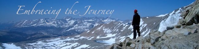
We hiked along the crest, with views to the west thick with smoke from all the forest fires raging in northern cali right now. To the right a light fog blanketed the mts; it was really beautiful.

Our next stop was Donner Pass, where the Donner Party was stranded in the winter back in the days of westward emigration, and they survived by eating the flesh of those fellow travelers that died. Mark commented how we should have taken a picture of him pretending to bite my arm, but we just didn't think of it at the time.

We had the easiest hitch ever. The first car we saw going our way stopped after we nonchalantly stuck out our thumbs. It was great! We got dropped off at the store, where I (Jess) got a fresh sandwich (with avocado...yum) that felt like it weighed 3 lbs! We also got some ice cream before hitching back up to the trail and heading 3 more miles downtrail to the I-80 rest stop.

This was exciting because there were bathrooms and water fountains- imagine...water we didn't have to treat before we drank it! It was great.

Then it was only 4 more miles or so before we came upon another Sierra Club ski hut, the Peter Grubb Hut (named for an avid Sierra Club member who died at the age of 18 in 1937). There were already a handful of hikers hanging out here, and we got sucked in once more to stopping early. We thought it would be fun to stay in a hut, since there were mattresses upstairs and moquitos outside, but we also realized that we could. Since it is the 3rd, the PO in Sierra City, our next town stop, will be closed tomorrow, so we don't need to get there until Saturday morning.

It felt like a rest day, in some ways, because of all our breaks and the fact that we stopped hiking today at 4:30! It was a really fun day, and tomorrow we will put in a bigger day in order to set ourselves up to be only a few miles out of Sierra City on Saturday. But tonight we got to enjoy time with other hikers, indoors, with a wood-burning stove to keep us warm (I mean overly hot).

In the evening thick smoke moved into our valley and we were glad to be sleeping in the hut. This is the thickest smoke we have encountered from all the fires. The direction of wind plays a big part in were the smoke goes.

This was also the day Mark surpassed his mileage from his 2003 southbound PCT hike of 1157 miles. So, he is now on his longest hike ever and has hiked more miles with Jessica than anyone. Sorry, Coach D you got the boot.


Total Miles:1063.0
Miles Today:20.0
Camp 67:Peter Grubb Hut

------------------------------
Tell your friend about PocketMail and let the savings start rolling in!

July 2:Mosquitos, Bears, and a Ski Resort

We woke up at our high point, and the mosquitos are already prevalent. We talk a lot about mosquitos, but when you live outdoors, it dictates a lot of what you do: where you take breaks, where you camp, what you wear, etc. Our route took us down for 6 miles through heavily forested areas, culminating at a stream that was swarming with the buggers. Normally we would take a break around then, but because of the mosquitos, we pressed on. Before we knew it we were on top of Barker Pass, with a light breeze, and very few bugs. When we looked at how far we'd come, we were surprised to find we'd gone 10 miles already, and it wasn't even 10am! We were also surprised to hear that JZ, whom we had camped with the night before, had seen 5 bears within 4 miles of our campsite! He had left 45 min to an hour before us, and we had seen nothing. The first three were a mother and 2 cubs. When they first saw JZ, the cubs shot up a tree, and the mother took off. A bit later, he came across a ma!
le and female. The female eventually went uphill, but the male hung around, and JZ got some great pictures of both. He was eventually able to walk by the male after he left the trail. We have heard that around here people are able to hunt bears so they have a natural fear of humans (vs the ones in the National Parks who see humans and know they can get food from them). It was just a crazy story to hear since we were just a few miles behind him and had no clue (thank goodness!).

Eventually our trail split from the Tahoe Rim Trail (after finally giving us some excellent views of the lake), and we spent the next few hours walking out on a wonderful, yet windy ridge. It was super beautiful and there were tons of wildflowers everywhere. We have so many pictures of wildflowers we could almost publish our own Sierra Wildflower guide!

Our goal was to head to Squaw Creek, but we stopped 0.4 miles short because we found a great breezy saddle that gave us relief from the mosquitos. It ended up that we, along with quite a big group of hikers, were camping in the middle of the Squaw Valley Ski Resort, and we fell asleep underneath one ski lift, with another in view.

Total Miles:1143.0
Miles Today:26.5
Camp 66:Squaw Valley Ski Resort

------------------------------
Allow us to help those in need, sell back your spare PocketMail and make some extra pocket money.

Thursday, July 03, 2008

July 1:Irony- Elevations and Food

We got a ride out to the trail from Gordon, a guy who is supporting a few other hikers, but is more than generous to give other hikers rides as well. We had gone out at Hwy 50, and the other few hikers had gotten a ride into town from Echo Lake, 1.4 miles downtrail. So we got dropped off first, and busted out the 1.4 miles just in time to head on down the trail with everyone else. It was fun!

We had been hearing about how beautiful the Desolation Wilderness was (despite the name), and we were not disappointed. There was a lot of rock, fewer trees, and great views.

Because it is 4th of July week, there are a TON of day/short-trip hikers out. We passed a lot of people, even a dad with his three kids, each one with a big backpack strapped to their back. The youngest was probably around 7! We laughed because that little kid had a pack on that looked similar to ours in size!

We meandered on, passing a string of lakes, the most beautiful being Aloha Lake. We climbed over Dick's Pass (9300 ft), and then walked down to Mosquitoville before camping at our "high point" around 8,200 ft. It's funny how our high points used to be our low points. We used to say, "Man! We have to go all the way DOWN to 8200 ft!" And now we are pumped to get up that high! Our mountains are getting smaller. In a couple days we will be down in the 4000's again.
One last perk for the day: we busted out a rehydrated meal today. I, Jess, ate a Lipton meal and Mark a Ramen. They were fantastic. A whole new world has opened up for us, and it's great to feel like we have "real food" for a change (although I normally would never call Ramen real food, it sure feels like it out here when you've been eating trail mix everyday). Kind of an ironic day.

Total Miles:1114.5
Miles Today:22.5
Camp 65:High Point with a View

------------------------------
Have a spare PocketMail laying around, sell it back to us and help those in need.

June 30:South Lake Tahoe

We had every intention of doing an in-out at Tahoe because we spent so much time in Bridgeport. We only had 7 miles to do into Tahoe, most of them downhill, so we planned on having most of the day to do what we needed to do.

Once we got to Hwy 50, it took us two hitches to get into town; it was okay though, because our first hitch dropped us off at a grocery store in Meyers, and we got to have some homemade mac-and-cheese from their deli before moving on.

Our second hitch took us straight to the PO, where we picked up two great packages: one from Mark's parents and one from our friends, Steph and Thad. They were awesome!! Thanks a TON! We then hit up the grocery store to add a few more calories to the pile (although our two care pkgs gave us most of our food). We did add an exciting element to our on-trail dining experience here; we had been hiking with a guy awhile back who was no-cook like us, but he had all these dehydrated meals he would rehydrate with water and just eat cold. So we picked up these Ziploc containers that seal tight (for liquids), and also picked up some Ramen and Lipton that we would rehydrate and eat cold. It was very exciting for us, and we were looking forward to giving it a try. Oh! We also got some instant pudding mix to whip up as well. Ah...the menu grows :).

After a quick trip to Starbucks, we were headed over to yet another grocery store, and we ran into our friend JZ, who had gotten ahead of us because of our time in Bridgeport. Long-story-short, we got talked into staying the night, along with a whole group of hikers, and we headed to the Nevada side of town to a casino for an all-you-can-eat buffet. It was totally worth it; we had a fun time, got a cheap room, and even got a ride back to the trail early in the morning from a guy who is supporting a few other hikers. It's really fun to start to get to know other hikers, but it also makes it easy to get sucked in. Luckily, it is all part of the experience, as long as you actually hike and don't spend too much time in town (where you spend money and time). So we spent another night in town, even though we hadn't planned on it, but it was a good time, and best of all...we got showers and good rest.

Total Miles:1093.0
Miles Today:7.0
Camp 64:South Lake Tahoe

------------------------------
Tell your friend about PocketMail and let the savings start rolling in!

June 29:Carson Pass

We woke up 18ish miles from Carson Pass. We wanted to get there during the day because we had heard that there was trail magic happening there and we wanted to hit that up if we could.

The trail meandered through some lower elevations (equals wet and mosquitos), but we were able to find some breezy, sunny spots to take breaks.

We made it to Carson Pass around 4pm; this isn't your normal pass. There is a highway going through it, a visitors/info center, and (happy day) bathrooms. Tons of people take day hikes from here, and it was a bustling center of activity for the hour we were there. We sat on some plastic chairs on the visitor center porch and ate some food, bummed that the trail magic wasn't happening until one of the volunteers who were running the center brought us out a bowl full of fresh fruit. We got to enjoy some cold cantaloupe, honey dew, blueberries, and grapes. It was fantastic!

We chatted with them (the two running the center) for awhile before setting off for a few more miles.

The trail sooned joined up with the Tahoe Rim Trail just passed an old cabin/barn in the middle of the Meiss Meadow. They have been restored, but used to belong to a family who summered there a hundred years ago. It was very picturesque and quaint.

We had read a note in our trail info that said "There are a lot of mosquitos between Carson Pass and Lake Tahoe," which we didn't notice too much until we went to camp. There were lots, but I think we are starting to break in a bit and figure out how to deal with them. I must say, I LOVE my headnet. Great invention! DEET too. Instant relief.

Anyway, we had 7 miles downhill to do to Hwy 50 where we would hitch into South Lake Tahoe, so we fell asleep knowing that tomorrow would be an easy day.

Total Miles:1086.0
Miles Today:26.6
Camp 64:Between Carson & Tahoe


------------------------------
Allow us to help those in need, sell back your spare PocketMail and make some extra pocket money.

Tuesday, July 01, 2008

June 28:Sausage with Wildflowers

We left camp this morning just after our British friends. We would leapfrog them until afternoon. In our morning walking we hit a meadow where the trail just disappeared. There was a bit of snow around the edges of the meadow and no sign of footprints or trail. This is common on the CDT, but not so for this trail. We walked what seemed to be the natural course the trail should take and then spent about 5 min looking for a trace of trail before another actually spotted it in the distance beyond a snow patch. It's always good to know you're on the trail, and it can be extremely frusterating if you lose it or suspect you got onto some side trail. We've been able to stay on the trail very well so far, but I (Mark) am fairly sensitive to direction and pretty good at reading a map when in question. Most hikers carry map pages from the guide books, but some almost never look at them. I sometimes scan them at breaks or if in doubt of the trails direction pull them out. One!
extra minute to confirm my direction is worth it to me. I hate walking a wrong direction and having to back-track. I do carry a compass which I only really use to orient my map to the north.

The terrain today was fairly gradual; we are losing the large elevation climbs of the previous week. We also began to come into a more volcanic landscape. Today actually reminded me of hiking in Oregon. We are leaving the High Sierra behind us. Today was an incredible day for wildflowers. They were out in force. In one saddle there probably 15 different types of flowers within 20 yards of me. We took some nice pictures.

I have to mention we briefly passed 4 weekend hikers, but in our short conversation one guy looked at the other and said, "Hey, did you want to pawn off some of that food?" He said, "yeah, I packed way too much," and pulled out 8oz of sausage! "Would you like it?" I replied, "Certainly!" This is better than getting handed a nugget of gold out here. I love when weekend hikers are generous with extra food (and often they have extra).

We later crossed a road at Ebbetts Pass and took a break just a bit on the other side. I noticed a few ants as I was getting something to eat, but just brushed them off if they crawled on me. Jess watched as I relaxingly took a sip of water and then immediatly shot up from my sitting position spraying water everywhere frantically did a little dance and ripped my shorts down to find and expel a biting ant. Wow! I had no idea the shot of pain one of those little guys could bring. Luckily once he was gone there were no lasting effects. But now I better understand the expression "you got ants in your pants."

Total Miles:1059.4
Miles Today:26.5
Camp 62:Gusty Sunset

------------------------------
Allow us to help those in need, sell back your spare PocketMail and make some extra pocket money.

June 27:A small hiking world

There was no rush in the morning. After hitting the Post Office and Bakery we begain trying to hitch out of Bridgeport. After about 25 min we got a ride from a guy in the navy heading home after some training. He dropped us at the intersection for the road that winds up to Sonora Pass. After another 20 min three young guys in a pickup squeezed us in the back of their cab. We were back at the trail just after 11:30.

We walked maybe 2 min and noticed a paper sign saying" Sonora Pass cafe, thru-hikers welcome." We walked over to a picnic area to find Hank with loads of fruit, cookies, and choclate cake for hikers. He does trail maintanence every summer and decided a few years ago he would do some trail magic for hikers. We relaxed and enjoyed some goodies along with some great Peete's coffee he brewed up. After this delight we didn't begin walking until after 12:30.

The climb out of Sonora Pass was rather mellow. Our packs felt great after mailing home over 3 lbs of ice axe and bear canister each. On the high point out of the pass we met some weekend backpackers who drilled us with questions for 20 min about our gear and hiking. We enjoyed answering questions for people so genuinely interested, and they were amazed at how small our packs were. They even gave us both a Cliff bar! I love when weekenders pack too much food.

The trail had a bit of snow leaving the highpoint, but soon we were cruising on trail again. The mosquitos were noticably less than the previous few days of trail.

After getting up from a dinner break we planned to walk another hour, but in about 10 min we came across a British couple we had previously met, the Duke and Yankee Clipper. We began chatting about the trail and gear; they made Ray Jardine's 2 person quilt kit and I was impressed. I asked how an English couple living in Scotland hears about the PCT and decides to do it. They replied some American friends they met actually hiked the trail in 2003. I said, "No way, I hiked south in 03 do you know their trail names? I probably crossed them." He couldn't remember their trail names, but could maybe check journals online. Then he mentioned he mentioned something about Paul. I said, "Wait, is it Paul Stonehouse?!"
"Yeah, you know him?" "Yeah he was at the university I went to and, I actually hiked 4 days north with him in 03." I couldn't believe it! I knew Paul was doing PhD work in the UK, but I had lost touch. I was regreting earlier not being able to send them a postcard from the trail. Paul had shared stories about the trail enough that these guys decided to go for it. There were funny things like, in 2005 Jess borrowed Amanda's ice axe for the JMT, and Yankee Clipper had just mailed back the same axe from borrowing it. We chatted until darkness set in and joined their campsite. I'm always amazed what a small hiking world it can be.

Total Miles: 1032.9
Miles Today: 14.6
Camp 61: British Friends


------------------------------
Have a spare PocketMail laying around, sell it back to us and help those in need.

June 26: Bridgeport Zero Day

Yep, another zero day. We made a 104 of our protein shakes today and we weren't going to be ready to checkout by 11am. So, another night in our 100 year old $40 room.

We spent a fortune at the post office, mailing back to the midwest two bear canisters, our irregular shaped ice axe box, and sending forward 3 boxes of shakes.

We went to the library for an hour of internet.

It rained just a bit in the city, but up in the mountains we later learned of some hail and lightning. It was short-lived though.

Ate food from the overpriced grocery store.

Made a few phone calls home.

And most importantly, we didn't walk much.

Total Miles:1018.3
Miles Today:0
Camp 60:Bridgeport Victorian Inn

------------------------------
Tell your friend about PocketMail and let the savings start rolling in!

June 25:Bridgeport,CA

We expected to wake up chilly on our high-altitude ridge, and yet the morning dawned bright and warmer than most of our mornings at lower elevations. We resumed our ridge walk up to the "highest point after Donahue Pass" at 10,880 ft and continued over two more ridge crests with spectacular morning views of the peaks and valleys below. Eventually we decended through some snow fields as the trail wound us down to Sonora Pass, where a road awaited us and we would head into town. We had just spent the last few weeks climbing up and over passes, so it was a wierd feeling to descend to a pass (it was also a lot less work!).

Since we don't cook while on the trail, we drink protein shakes each day as part of our diet. Instead of preparing them all ahead of time, we sent bulk supplies to three places along the trail, Bridgeport being one of them, so we knew we would spend a day there making shakes and sending them ahead on the trail.

The hitch to Bridgeport is supposed to be somewhat tricky because you have to take two roads to get there, but we lucked out. There is a guy who is supporting several other hikers by meeting them at roads and getting them to towns, keeping stuff in his van for them, etc. When he's waiting for them to show up he often gives rides to other hikers as well. So he gave us a lift into Bridgeport, which is a 50 mile round-trip for him. We happily gave him some gas money for his generosity (and because gas here is $5.29/gal. Yikes!).

We grabbed some food and got a room at the Victorian Inn, a hundred-year old hotel that was one of the cheapest in town (also very basic, but decorated with a Victorian flair). We did the normal grocery and PO runs before grabbing a pizza and settling in for the night.

Total Miles:1018.3
Miles Today:5.8
Camp 59:Bridgeport Victorian Inn

------------------------------
Allow us to help those in need, sell back your spare PocketMail and make some extra pocket money.