Sunday, December 28, 2008

Update

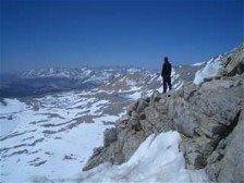
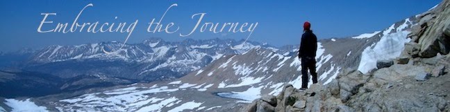
Mt. Bachelor is the local ski resort, and we were lucky enough to move here when they were beginning their hiring process for the winter season. We have always thought it would be fun to work at a ski resort (last year we almost took jobs at Vail Resort in CO). When we passed up the Vail jobs, we thought we may be passing up this opportunity all together, so we were excited to find out that we might get jobs at Bachelor. Unfortunately, because of the state of our economy, they had an overwhelming amount of applications...way more than normal. Mark just recently got a job as a snowboard instructor at Bachelor, which is very cool, because he gets a free season pass. I didn't want to wait around, so I ended up getting a job at a book store/coffee shop and a seasonal job at Bath and Body Works. I also just recently took a "holiday on-call" (read: week-long) job at Bachelor selling tickets. Not only do I get paid, but I get a free day lift ticket for each day I work. It's pretty nice. I'll take a free day of riding any time!
We are enjoying Oregon a lot though. It has been snowing a ton, and we definitely had a white Christmas. Because our families are in the midwest and our jobs wanted us around for the holidays, we stayed here. I would have guessed one or both of us would have actually had to work on Christmas day, but luckily, both of us were off and we got to spend the day together, relaxing and gearing up for the days ahead.
We found a church we like, and are looking forward to getting to know people and getting more involved. They have this great 5 minute break between the music and the sermon where parents take their kids to their classes. The rest of us get to chat with those around us, and we have met some great people in that 5 minutes. We even got invited to a Christmas party by a couple and we really had a great time! So, it's taking time, but we are getting involved and figuring out what life for us will look like here. It's definintely not all neat and tidy, but it's slowly but surely shaking out to be what we (and God) would have it be.

Monday, November 24, 2008

East of Eden


Just a couple days ago I finished reading Steinbeck's East of Eden for the second time, and as soon as I read the last word I wanted to start over again. If you haven't read this book, it is the book he felt he had been waiting his whole life to write. It is loosely based on his family history as well as the Biblical story of Cain and Abel and explores the themes of good and evil and generational sin ("it's in your blood"). I am partly smitten by this book simply because it took place in the late 1800's to the early 1900's. It is a time in history that I have always been fascinated by, I think, because the way of life was so different than now, and in the big scheme of things, it wasn't that long ago. But apart from the historical insight, Steinbeck is one of those writers who has incredible insight into the human psyche and nature that makes me really stop and ponder as I read. It's a long book and there's so much to it, that I really just want to keep reading it over and over.
A friend/professor of ours from college has done several reading/discussion groups with this book, and I only wish I had been around to be a part of one. He is currently just starting in on reading the whole of Steinbeck's work, which I would hope to do one day as well. East of Eden is definitely at the top of my list of all-time favorite books and would recommend it to anyone who is looking for a book that is a great novel, but one that will really make you think. Just last night I started in on A Journal of a Novel: The East of Eden Letters, which is the journal/notes Steinbeck kept while writing the novel. I hope it will be an interesting read with insight into his thought process and writing process.
I'd love to hear any thoughts from others who have read the book...

Monday, November 17, 2008

Things I Want To Do in Life

I decided that I wanted to be better at making things from scratch. I get tired of all the hydrogenated oils, high fructose corn syrup, preservatives, and other unnatural ingredients in all my foods. When we got to Oregon, I made a list of things I wanted to learn to do at some point in my life. A few of the domestic-type things were: make bread, learn to sew (I once learned this, but haven't done it in so long, I would be relearning this once-common activity), can (fruits, vegetables, etc), plant a vegetable garden, and grow my own herbs to use fresh and/or dry them for later use.
So since we live 10 steps from the library, I decided to pick up a few books on baking bread. I found one called, "The Bread Bakers Apprentice." It is pretty in-depth; I had to learn a whole new language to really understand it all, but I decided to give it a whirl. It took me two days.
Day 1, I made what is called a soaker and a poolish. Basically, some flour, grains, water, yeast that had to sit overnight.
Day 2, I made the bread. There was a lot of specifics of how long to knead it, let it rise, divide, rise, bake.
As you can see from the picture above, I ended up with two, whole-wheat loaves that were really yummy! I was really proud of my first bread-baking attempt and turns out it was really fun! It's so cool to eat bread that wasn't bought in a store, but that I made in my own kitchen. I can't wait to try the next kind!

Sunday, November 02, 2008

Oregon Locals

This is us as we are getting ready to leave for Oregon. Yes, cheesy, I know. This should be a picture of us already in OR; however, our camera is still packed away in a box in the minivan. Thus, all you get right now is a picture of us in Mark's parent's garage :).
We loaded up Mark's parent's minivan and our car, and headed out for at 27 hour drive cross-country. We spent a night with friends in York, NE because there were "blizzard-like conditions" in western Nebraska. Our second night was spent with a friend we met in SD, Jonathan Elliot. The air force had just assigned him to a base in Utah, and it just so happened to be on our way. We had a great time getting to spend time with people we hadn't seen in awhile, and it made the trip a lot easier to break it up. Did you know that ther's absolutely NOTHING in Western Nebraska, Wyoming, and most of Utah? Eastern Oregon doesn't have much either, and even though there isn't much there, it's absoulutely beautiful! Day three, we finally arrived at our destination.
Since we couldn't get into our apartment for a few weeks (which later fell through), the parents of our friend, Aaron, were generous enough to let us stay in their little guest house that is behind their home just outside of town. This is where we've been for the last week.
Our time has been spent looking for apartments (since the first one fell through AFTER we got here), and jobs. Applications are out to a few places, and a few more will go out still, and then we just wait, pray, and hope that things fall into place.
Why did we choose Oregon? We had visited Aaron and Annie on a past vacation and really enjoyed the city. Then, when we hiked the trail, we stopped by again, and since we didn't have any commitments to a location when we were done hiking, we decided to move back here. We've lived in the Midwest our whole lives, and yet we are in love with the mountains. It was time for us to try living in and near them. And so, here we are. Giving it a whirl. Our hope is to take advantage of the beauty and adventure that is at our fingertips out here: hiking, biking, snowshoeing, snowboarding, cross-country skiing, winter camping...mountains to climb and wilderness to explore. And in between, I guess we'll have to go to work :).
Want to come visit?

Sunday, October 19, 2008

California pt 1::Mexico to Kennedy Meadows

We were in CA for 3 of the 4.5 months, so there are quite a few CA pictures. Hope it's not too many! Enjoy!

Here we are in the QC Airport before we left for the trip.

This is the Monument that at the Mexican border. The metal wall you see behind us is the border! See how nice and shiney and clean we are?

A view looking down the dirt road that the border patrol uses to...well...patrol the border.

Jess touching the wall.

These signs aren't along the whole trail...just at mile 1.

Our first campsite, just off the trail. This night we had 37 illegal immigrants walk by us!

Most of the nights in the desert we just slept out. It never rained, so we didn't really feel the need to use our tarp.

A great view of the brushy desert mountains.

We set up our tarp for shade one day in the desert during a break.

These cactus flowers were my favorites.

Eagle Rock. No question why it got it's name! It's a natural formation.

Here is what our typical desert trail looks like.

The biggest pine cones (and heaviest!) I've ever seen!

Our hotel in Idyllwild. This was our first of three places where we made up our protein shakes to mail ahead. I think we each made about 50!

This is how we got our water along the way...then we treated it with bleach to kill, what Mark's grandma called, "skeegleweegles." :)

We had just descended 6-7,000 ft down to the desert floor. It was HOT here. Behind us, you can see Mt. San Jacinto at over 10,000 ft. We were trying to squeeze ourselves into the shade by this boulder.

We hiked nearly 200 miles only to have our first bear be in a cage. This bear will be trained and used in movies.

The biggest rattler we saw.

Mark is sitting in the Deep Creek hot springs. The water behind him is cold from the creek and the water he's in is from the hot springs.

I had to include a picture of a horney toad because Mark took TONS of pictures of them before we got this good one!

We walked through several ski resorts, so we decided to get our picture taken on the lift!

Mark is an Eagle Scout, so we had to get his picture on the summit of Mt. Baden-Powell (he's the founder of the Boy Scouts). We only had to walk 1/3 of a mile out of the way and a couple hundred feet up to get here from the trail.

Another view of the desert mountains.

Vasquez Rocks State Park, near Agua Dulce, CA.

The most famous trail angels on the whole trail are the Saufley's, who run Hiker Heaven.

A brushy desert view.

500 Miles!!

We saw this in a field as we walked near a ranch.

As we walked the desert floor through the Mojave, we found shade under a Joshua Tree.

This was a burn area, but was more what we would have expected the desert to be like.

In Souther CA, especially around the town of Mojave, there were thousands of wind turbines everywhere!

A water cache in the desert. We were VERY thankful for these!

This was the windiest day of the whole trip. We could barely walk straight the wind was blowing so hard!

Sleeping out...look, I'm journaling!

At the Post Office in Onyx, CA. This is our bounce box sprawled all over (the box we sent continually up the trail to ourselves).

A sunset. This is where we first started noticing the mountains getting bigger as we got closer to the High Sierra.

California Pt 2:: High Sierra to Oregon Border

At Kennedy Meadows, the enterance to the High Sierra, we had to pick up our ice axes (in the aptly shaped box in Mark's hands) and our bear barrels...those wonderful black containers that weigh 2.5 lbs empty.

This fire had kept previous hikers from walking through. We heard this part of the trail was okay to walk through, but then we saw this smoke. There were still a few fire fighters around and a few rangers montering it, and a few days later it started back up (after we were long past it, we could see the smoke rising from a ridge behind us).

A view from the climb up Mt. Whitney. The lake on the right is named Guitar Lake.

Here we are on the summit of Mt. Whitney, 14,495 ft, the highest point in the lower 48 states.

We were always excited to see a way across the creeks that didn't involve us getting our feet wet, whether it was a bridge, a log, or rock hopping.

Forester Pass is the highest point on the official PCT at 13,200 ft. Mt. Whitney is a side hike.

Mark at Forester Pass.

The Kearsarge Pinnacles.

We did a side hike out over Kearsarge Pass to resupply in Independance, CA. We stayed at a hotel in Bishop, CA, which had a grill we could use. A bunch of us bought some food at a local grocery and Wiz Kid offered to grill it up for us.

Jess postholing (sinking into the soft snow) as she descends Glen Pass.

Climbing up steep Mather Pass. This is the only pass we used our ice axes on.

One of the many incredible views in the Sierras.

I had lasik done a month before we left, so I got to put these wonderful eye drops in 6-8 times a day!

Beside Evolution Lake, just after Muir Pass.

Just after crossing Evolution Creek. It is one of the top two creeks that have the reputation of being the worst crossings. This year, it wasn't too bad. In 2005 when we hiked the JMT, it was roaring white water.

Mark admiring the view from Seldon Pass.

One stop is at Vermillion Valley Resort. There is a ferry that shuttles you across Lake Edison so that you don't have to walk the 5 or so extra miles in. The lake was so low this year that they hadn't gotten the ferry in yet and were using these small fishing boats.

Mark crossing a creek.

One of the best views we had one a break: Lake Virginia. Isn't it postcard-esque?

Snowplant.

For about 14 miles, the PCT and JMT split. The JMT goes down by Shadow Lake, nestled under Banner and Ritter Peaks (shown above).

Thousand Island lake.

Jess and JZ as we head down from Donahue Pass.

All the snow had melted out except this small ridge of snow on the trail. If you slip down the right side, you fall between the snow and the rock; if you slid down the left side, you landed in a white water creek. Luckily it wasn't a long walk!

Crossing the 1000 mile mark!

We camped high on this rocky ridge a few miles short of Sonora Pass. We had to clear a space in the rocks to sleep!

One of our last views of big snowy mountains.

Mark in a field of Mule's Ear flowers.

Aloha Lake in the Desolation Wilderness.

These were some of the wierdest and coolest "flowers" we saw on the trail.

After we hitched around a forest fire, a crew of us ended up sitting on this patch of lawn outside a grocery store for a few hours in Chester, CA.

A boiling Lake in Lassen Volcanic National Park.

The only Mountain Lion we saw on the whole trip was dead and frozen in a locker. A forest service guy offered to show it to us. It had been hit by a car.

Burney Falls in Burney Falls State Park.

One of the many incredible flowers along the way.

Squaw Valley/Creek. (one of two along the way).

This is where Mark ended his hike with Coach in 2003. We had to hitch at the on-ramp to I-5 to get to Mt. Shasta (the city).

Castle Crags State Park.

Oh, my wonderful heat rash. We figured out later that it was from my pants that had a chemical in them called Buzz Off that was an insect repellant. It worked pretty well at keeping away bugs, but when it was hot out, gave me a rash all over my legs.

It wasn't very often we had to sleep on the trail, but this day we had hiked 32 miles to a spring and were dead tired. So, up the tents went on the trail. As you can see, it's not the best campsite ever.

This is Billy Goat. He is a famous hiker, who lives on the trail nearly year round. He is retired and loves hiking so much, he finds trails to hike most of the year. The LA times featured an article on him. To read, click here.

This is what most of northern California looked like...smokey haze from all the forest fires.

We hadn't seen snow for awhile, and then we came around a corner to see this big pile of snow!

A great old car in Etna, CA. We figured it was just an old car sitting around, and later we saw it driving around town!

We ran into some cavers who took us into this cave near Marble Valley.

This was the worst day of smoke on the whole trail. We walked with bandanas over our faces for awhile. We were pretty much whited-out for a good chunk of the day.

We would often wash out our shirts, socks, etc in creeks when we could...especially if it was hot out. Mark actually dove into this creek...it was VERY cold water! Notice the great hiker tan he has on his arms and legs!

A view at the top of the incredibley long climb out of Seiad Valley, CA.

In Northern CA we would often come across cows. Not sure how it all works, but ranchers let their cows wander and graze in the mountains. Unfortunately, it meant that the water sources were often contaminated by cow pies...one good reason to treat your water! We skipped those ones if possible.