We were in CA for 3 of the 4.5 months, so there are quite a few CA pictures. Hope it's not too many! Enjoy!
 Here we are in the QC Airport before we left for the trip.
This is the Monument that at the Mexican border. The metal wall you see behind us is the border! See how nice and shiney and clean we are?
 A view looking down the dirt road that the border patrol uses to...well...patrol the border.
 Jess touching the wall.
  These signs aren't along the whole trail...just at mile 1.
 Our first campsite, just off the trail. This night we had 37 illegal immigrants walk by us!
 Most of the nights in the desert we just slept out. It never rained, so we didn't really feel the need to use our tarp.
 A great view of the brushy desert mountains.
 We set up our tarp for shade one day in the desert during a break.
 These cactus flowers were my favorites.
 Eagle Rock. No question why it got it's name! It's a natural formation.
 Here is what our typical desert trail looks like.
  The biggest pine cones (and heaviest!) I've ever seen!
 Our hotel in Idyllwild. This was our first of three places where we made up our protein shakes to mail ahead. I think we each made about 50!
 This is how we got our water along the way...then we treated it with bleach to kill, what Mark's grandma called, "skeegleweegles." :)
 We had just descended 6-7,000 ft down to the desert floor. It was HOT here. Behind us, you can see Mt. San Jacinto at over 10,000 ft. We were trying to squeeze ourselves into the shade by this boulder.
 We hiked nearly 200 miles only to have our first bear be in a cage. This bear will be trained and used in movies.
 The biggest rattler we saw.
 Mark is sitting in the Deep Creek hot springs. The water behind him is cold from the creek and the water he's in is from the hot springs.
 I had to include a picture of a horney toad because Mark took TONS of pictures of them before we got this good one!
 We walked through several ski resorts, so we decided to get our picture taken on the lift!
 Mark is an Eagle Scout, so we had to get his picture on the summit of Mt. Baden-Powell (he's the founder of the Boy Scouts). We only had to walk 1/3 of a mile out of the way and a couple hundred feet up to get here from the trail.
 Another view of the desert mountains.
 Vasquez Rocks State Park, near Agua Dulce, CA.
 The most famous trail angels on the whole trail are the Saufley's, who run Hiker Heaven.
 A brushy desert view.
 500 Miles!!
 We saw this in a field as we walked near a ranch.
 As we walked the desert floor through the Mojave, we found shade under a Joshua Tree.
 This was a burn area, but was more what we would have expected the desert to be like.
 In Souther CA, especially around the town of Mojave, there were thousands of wind turbines everywhere!
 A water cache in the desert. We were VERY thankful for these!
 This was the windiest day of the whole trip. We could barely walk straight the wind was blowing so hard!
 Sleeping out...look, I'm journaling!
 At the Post Office in Onyx, CA. This is our bounce box sprawled all over (the box we sent continually up the trail to ourselves).
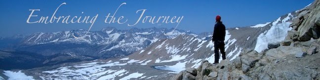
 A sunset. This is where we first started noticing the mountains getting bigger as we got closer to the High Sierra.
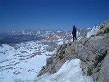

2 comments:
Julie and I spent many hours under that rock after a long day down from San Jacinto. Thanks for the memories...and congrats on a wonderful hike!! Where are you going next?
Wow...you've got amazing pictures!!!!
Post a Comment