Tuesday, September 30, 2008

September 28:Last BIG Climb

We woke up to the sound of music still pulsing loudly from the speakers across the road/river.
It had gone on all night with no breaks, and I was amazed to still see people dancing and milling around the resort. How do they do it? One guy was even going nuts on the trampoline, flipping all over the place and throwing in some break dancing moves for variety.

We walked to the rest stop nearby where we camped and sorted through our food and packed up. Other people who stopped at the rest stop to use the bathroom seemed amazed at the music and the scene across the river as well. One guy even muttered, "So much for getting out into nature!"

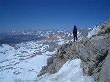
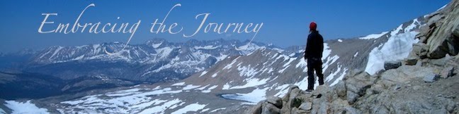
About 9:30am we headed up the trail and began the 4600 ft climb that would be our last big climb of the trail. Once we got up high here, we would stay high. Luckily this climb was spread out over 15 miles or so, and it made the climb more bearable.

We had read in our notes that the trail had been rerouted around some slides, but it was a brief mention with no indication of where or how many reroutes there were. We were mid-climb, and hit a spot where the trail split. Our maps indicated that we should go up (while the other split went down), but someone had put some logs across the up portion of the trail, which usually indicates that i's not the PCT. We wondered if this was a reroute area, but there were no markings, so instead of heading downhill, we took the high trail. Our first indication that this was not our trail anymore should have been the massive overgrowth that made it near impossible to navigate. But we kept at it until it just ended at a major washout, causing us to turn around and take the reroute downhill and across a stream. It was good because we knew for sure we were on the right track, but it cost us 30 min or so. Luckily it was the only reroute; since we didn't have a map for this, it took us awhile!
before we knew exactly where we were on the map again. I am thankful, once again, that the PCT is well traveled and maintained. In those moments of uncertainty, it is almost always easy to follow...unless you hit a meadow where the trail is lost in the tall grasses, which is what happened soon after. Here I was thankful to those who went before us andput rock cairns in the meadow to mark the way.

We camped near a gravel road at Cold Springs, a wonderfully gushing piped spring. It was easy to fall asleep after a long day of climbing. Earlier, before we left Belden we had finally thrown away our makeshift, garbage bag pack covers because the skies had been blue this whole section. Mark even said the famous last words, "It won't rain today." So of course the skies let a few droplets fall in retaliation to that comment. It was only a few, andit lasted for maybe 10 minutes. The tarp was dry in the morning.

Only one full day left of hiking from here!

Total Miles:1308.6
Miles Today:19.3
Camp145:Glad the Climb is Over

September 27:Belden Town Resort

This is how some previous thru-hikers described Belden in one of our note guides: "Belden is creepy;" "My opinion of Belden is that it is a haven for hard drug/alchol abuse;" "This place sucks." So needless to say, we were interested to see what it was like.

We had a somewhat longer day to get into this "town," but the trail looked good in our notes, so we figured we could do it.

We had a pretty smooth day but for one small glitch. There was one point where the trail hit a "shady glen" where the trail shot left. At the same moment, we went around a downed tree, and followed what we thought was our trail to the right. It was wel worn, but soon became hard to follow through a meadow (filled with cows). Eventually it completely disappeared, and we decided to shoot left, knowing we had to run into it at some point. Luckily we ran into it within minutes, but we had already lost 20 min or so rooting around in the woods. A mile down the tubes.

Back on trail, we eventually began the crazy descent into Belden. We dropped 3000+ ft into the valley, and I was already dreading having to climb back out the next day.

Just as we were nearing the road we ran into three people (20's-ish) who seemed to be out for a stroll. They were dressed really strangely (costumes...I hoped), and they told us Belden, which is a resort town (7 local residents!) was rented out for a party this weekend. Interesting. We wondered what this would mean for us since we no place else to go.

We hit the road and walked for a inute or two and started seeing cars and hearing music. The North Fork Feather River runs through the valley and it was lined with tents for three quarters of a mile.

Then we hit town.

More tents. Hundreds of people. Crazy costumes. Loud music. A guy came over to us and asked what we were up to. He explained that this was a Burning Man-esque party weekend. They were a "community of people who like to party." And we had walked into the middle of the Dr. Seuss party night. Hence the costumes. They had art all over, swing sets, a trampoline, a dance floor, a magician,and VERY loud music. It was pretty crazy. Everyone was super nice, and we were invited to stay and enjoy the festivities; being that we weren't into drugs and alcohol, we decided to hit the restaurant and store and find a place to camp.

We ended up heading across the highway near the trail and setting up camp there. We were more than thankful we had earplugs because the music was pumping LOUDLY all night. No joke. It never quit. Not once. Regardless, we slept surprisingly well and decided to sleep in a little in the morning before heading out and up.

Our consensus on Belden? Not really creepy, persay. Possibly a haven for hard drug and alcohol abuse, though. It's a place to walk through, but not a place you think, "We should go THERE for vacation."

Total Miles:1289.3
Miles Today:26.8
Camp 144:The Rave

------------------------------
Refer-A-Friend to PocketMail today and a receive $50 in service or $25 in CASH!

September 26:Lot of Down; Lots of Up

We began our day knowing that it would be a unique day of hiking- not unique for the trail, but for most sections outside of the High Sierras. We would spend most of the morning descending 3000 or so feet down to the Middle Fork Feather River, and then climb back up 3300 ft and into the Bucks Lake Wilderness. There wasn't much variance outside of down, down, down...up, up, up.

It was a rather dry section, so we hauled 2-3 liters most of the day; it has been so dry that we could never be sure water would be where we were told it would be. Springs would be dry or just a wet mud spot on the trail; creeks would be nothing more than a rocky hollow we walk over. This has made the walking feel more like the SoCal desert, and we end up with water-heavy packs.

Not only did the descent take us back into poison oak territory, but there was also this unfriendly phenomena of tiny little flies that would hover around your face and kamikaze dive bomb your mouth, nose, and eyes. We quickly decided the headnet was worth it, and dug them from the recesses of our packs (ah, the good ol' days!). The headnet comes through again! Luckily they didn't bite; they were more annoying than anything. The other bonus is that since it's almost October, the poison oak was very dry and somewhat sparse. It was wierd to have it appear just over 4000 ft. I had gotten so used to it showing up at 1000 ft or so in Washington.

We hit the Middle Fork around lunch time and took a break on some rocks on the bank of the river. It was a nice respite from the face flies since they had no desire to follow us down to the water from the trail. The trail actually stays a little ways above the river and walks you across what the guidebook says is the "biggest equestrian (and hiker) bridge on the PCT." It's a pretty cool bridge, but in order to enjoy the water, you have to scramble down some rocks on a makeshift trail.

We began the climb up in the hot afternoon sun, cursing the weight of the water on our backs. It was a long, sometimes steep, cluimb up, and by the time we hit the top of the climb, just around dusk, we were beat. I didn't want to do anything but sleep- not eat, not journal, nada. So I didn't. I tried to eat my spaghetti, but after a couple bites, put it away and fell asleep pretty quickly, only waking up to roll over or throw out the ant that had crawled, not just into my sleeping bag, but into my shirt and up my arm. It's a creepy feeling when you're half asleep!

Total Miles:1262.5
Miles Today:24.7
Camp 143:Top-O-the-Climb

------------------------------
Tell your friend about PocketMail and let the savings start rolling in!

September 25:Quincy-LaPorte Road

We tanked up on water at Summit Lake because the miles ahead were dry and dusty. The trail continued to wow us with beautiful views and miles that, although weren't easy, weren't really hard either. It always amazes me, and it was no different here, how we can look at the data book and see descents, and the trail always manages to take you on a climb first. Oh the joys of knowing too much and having expectations because of it. :)

The other thing that stood out about today was the wind. It was WINDY! Not the strongest wind we've had yet, but constant, blow you sideways, hard to walk wind. Sometimes a little wind feels nice if it's warm out, but this was just a bit much. We had to try hard to find places we could take a break without all our stuff blowing all over!

Toward the end of the day we crossed Quincy-LaPorte Road. We had taken a dirt road the last mile there (it paralleled our trail and took us closer to the creek we were aiming for, eliminating backtracking). The reason this road even stands out to us at all is that it was the official beginning of the fire closure earlier in the summer. We could have hiked to this roiad, but it gets very little traffic and would have been a hard hitch (out and then back in later when we came back). It was fun being there and knowing we were heading into territory where very few thru-hikers had gone this year.

We camped a couple miles passed this road, clearing some sticks to make a space our tarp would fit in. Throughout the night we kept hearing the crunching noises of some animal moving around, but Mark made some noise and it ran off. We were pretty sure it was a deer by the sound of it's footsteps. Day two down, four to go!

Total Miles:1237.8
Miles Today:26.0
Camp 142:In the Sticks

------------------------------
Allow us to help those in need, sell back your spare PocketMail and make some extra pocket money.

September 24:Back to Sierra City

Jim and Jan were kind enough to offer to drive us to Sierra City, even though it was a two hour drive for them one way. We rolled into town at noon and had a great picnic lunch while we waited for the PO to open (they closed for lunch). About 3 months ago we had mailed ourselves a box of shakes and guidebook pages, and when we realized we were going to skip the section, we asked if we could have them hold it for a time. They had me write in big, bold letters with a red permenant marker, "Hold until July 30." Our plan was to call at the end of July and have them forward it to Cascade Locks, with full intentions of sending it back to them so we could pick it up when we came back to hike this section. For whatever reason they never forwarded it (we thought it was lost in postal no-mans-land), and it was still waiting for us when we showed up. Score.

We hit the trail at 1pm (in shorts and tshirts nonetheless!), and began the 2700 ft climb out of Sierra City. The bummer is that there was no water for 14 miles, so we lugged 3 liters of water each up the hill. Luckily the climb wasn't too bad, but the views of Sierra Butte and beyond were gorgeous! Awhile back another hiker (thru-hiker in 2007) wrinkled her nose and told me I wasn't missing anything in this section; boy was she wrong! The views have been incredibly beautiful so far. We have loved it!

Thus far the trail has been extremely dusty and dry. Many of the water sources are dried up by this time, and only the most reliable ones are still flowing. It's hard to judge how much to carry. We will probably just end up carrying way more than necessary just to make sure.

We hiked in about 14 miles to our first water source to camp. We made camp and slept better than we have in a long time. Hiking is starting to feel normal again...

Total Miles:1211.8
Miles Today:14.2
Camp 141:Summit Lake

------------------------------
Have a spare PocketMail laying around, sell it back to us and help those in need.

September 22-23:More In-Between

Amanda dropped us at the bus station just in time to catch our bus to Truckee. We were to transfer buses in Sacramento and arrive in Truckee around 5pm.

If only it had worked out that way.

We only had a one hour layover in Sacramento, and we used the time to eat and make a few phone calls. Unfortunately the person making boarding calls sounded like the nanny on Muppet Babies ("waa waa waa waa"). Thus, we looked up just in time to see our bus pull away ON TIME. Can you believe it? A Greyhound left on time for once, and we missed it.

There were no other buses that were going to stop in Truckee until the morning, but the nice lady behind the desk worked her magic, and wahlah (how do you spell that?), she had the last bus to Reno stopping in Truckee for us! The bonus was that we didn't have to pay for another ticket. The downside was that we had to sit there for 4 hours bored to tears.

By the time we left, it felt like we had been there for days, but we were just happy to get on a bus (which, of course, did not leave on time).

We arrived in Truckee around 9pm and were picked up by Mark's relatives, Jim and Jan, who live on Lake Tahoe. We had tried to connect with them when we hiked through here before, but it hadn't worked out. We were excited to get to meet/know them a bit.

We spent the whole next day with them. They showed us around the area, and we enjoyed some great meals on their deck overlookong the lake. We also really enjoyed hearing about their adventures. They are two of the most active people we know; they are constantly hiking up mountains, kayaking, running, swimming, or playing tennis. They have also been into windsurfing! They asked tons of quwstions about our hike, and we had fun sharing our stories and expanding on what we've journaled about.

We were really thankful for their hospitality, generosity, and enthusiasm, and look forward to connecting with them again in the future!

------------------------------
Tell your friend about PocketMail and let the savings start rolling in!

September 21:Redding, CA

We woke up to the sound of a car driving by, heading up to the hiker's parking lot. We scrambled to peak out of the tarp as they drove back down, giving us a litle wave, and having no idea that we needed a ride out of the mountains.

We packed up, wanting to be ready in case another car happened by, but after an hour or so, we decided to walk a little ways. It was 7 miles down the road to a main road that would take us out to the highway. We didn't want to have to walk those 7 miles, but since we had no idea when anyone would be leaving, we decided to make some progress.

We walked a bit, sat in the sun a bit, and when two cars drove by in an hour, both going the wrong way, we got up to walk again. We resigned ourselves to the fact that we would be walking the 7 miles down to the main road.

After a couple more miles, we finally had a truck come our way, and we jumped in the back, happy to finally have a ride. They took us most of the way to the highway, but were turning off to head home. This is where it gets funny.

A pickup truck with three twentysomethings drove by, and 100 yrds down the road, turned around and secided to give us a ride "into town," as they put it. We hopped in the back with all their luggage, and were excited to find a big pillow to sit on. They dropped us at a gas station, and as they went to ask directions to wherever they were going, we walked out to the highway to see if we could get a ride. Guess who picks us up? Yep, the same pickup with the same comfy pillow. They were headed our way, and took us all the way to Yreka. We got a kick out of being picked up by he same car twice in a row.

At Yreka, they dropped us at another gas station. Here we would have to hitch on the on-ramp to the interstate. They drove off, and we hung around for a few minutes before walking over to the I-5 on-ramp. We stood there for maybe 5 minutes when who should appear but the same pickup truck. They pulled over, and we now learned that they were headed to Sacramento. Redding, where we were headed, was on the way, and they were happy to drop us there on their way by. We couldn't believe it! What are the odds off being picked up by the same people three times in a row? We laughed, thinking that this could only happen when riding in the back of a pickup, since we couldn't talk to anyone in the cab during the ride.

Our plan was to connect with Paul and Amanda in Redding for the night. Paul had been an RD at IWU when we were there, and they had also hiked the PCT in 2003, the same year Mark hiked with Coach. We had run into a couple from Scotland on the trail who had gotten the idea to hike from Paul and Amanda while they were doing some schooling in the UK. It was a random connection, but we were excited to connect with them and meet the new addition to their family, Finn.

We were dropped at yet another gas station, where Paul and Amanda picked us up. It was evident right away that they had been thru- hikers. They offered up all the things that thru hikers are looking for: showers, laundry, internet, food. They even asked the question, "Do you want some cotton to wear while you're here?" which is just another way of asking, "Do you want to wear something other than hiking clothes?"

We had a blast with them. It was fun hearing about their journey and the job Paul just started as a professor of Outdoor Leadership at a local university. It was fun sharing stories about the hike since they had an idea of what it is like. When we got there, they had no desire to really hike the desert sections they missed. By the time we left they were itching to throw Finn in a backpack and hit the trail. They were more than generous. It's amazing how previous thru-hikers are always excited for the chance to "pay it forward" and be trail angels to other hikers.

We topped off the night with dinner from the famous In-and-Out Burger and then we made homemade ice cream in this crazy contraption from REI. It was some of the best ever!

We had such a blast with them, and look forward to the possiblity of connecting with them again before we fly home!

------------------------------
Allow us to help those in need, sell back your spare PocketMail and make some extra pocket money.

Monday, September 22, 2008

September 20:In the Marbles

We woke up, ate breakfast, and then climbed out of the tarp to find ourselves in a cloud. We were surprised, because the night before was clear, and the dark clouds were high in the sky. It seemes fitting, and a bit ironic, because the last time we hiked part of this section we were whited out by smoke from the nearby fires. It felt like we would end up with no views of the Marble Mountains whatsoever, regardless of when we hiked it.

It was chilly, but by the afternoon, the clouds had started to break up a little, letting the sun peek through and warm us up a little.

It was really fun to get to see what all the hype was about. We had heard from so many others how beautiful these mountains were, and they were right! The rocky ridges and alpine lakes were incredible. We wove in and out of trees, but for the most part, the trail was rugged and rocky and hard on the feet.

We knew that giving our feet, knees, and legs 10 days off would make jumping back in a little hard. We were hoping that it wouldn't feel like starting over, which luckily it didn't. Our knees and feet screamed at us (we had tricked them into thinking we were done!) for making them walk all day again over such rugged terrain, but it served as a great warm-up for the longer section we still had to hike a bit farther south.

We rolled into Marble Valley in the late afternoon, excited to reconnect our steps for this first section of trail. We took a short break, and then headed down the Canyon Creek Trail that would take us the five miles down to the Lovers Camp Trailhead. My feet told me that I had walked 35 miles, when in reality we had only done 24.

We were hoping that there would be someone there that was heading down out of the mountains that we could snag a ride with. We figured our odds were pretty good since it was 1)a Saturday, and 2)opening weekend of hunting season. Unfortunately, we saw lots of cars but no people. This trailhead is pretty remote, but it seems like it gets a fair amount of traffic, so we weren't too worried.
We wandered down to the parking lot for cars pulling horse trailers and ran into two hunters hanging out by their camper. We chatted for a bit, and they let us sit in their camp chairs (luxury) and fed us some fruit and zucchini bread. They weren't leaving until the following afternoon, so once it got dark we wandered over to a nearby campsite and set up for the night. Our hope was for a ride from someone leaving in the morning. We slept well, section one of the mop up tour behind us.

Total Miles:1630.4
Miles Today:19.1 (+5 mi on Canyon Crk Trl)
Camp 137:Lovers Camp Trailhead

------------------------------
Have a spare PocketMail laying around, sell it back to us and help those in need.

September 19:Back to Etna, CA

We were up and ready to go by 6:30am. We drove out of Bend and managed to stay gone this time :). The drive down Hwy 97 is beautiful, and we enjoyed the views of Mt. Shasta that were clearer than when we hiked through.

We hit Yreka around noon. When we returned our rental car, the lady working gave us a number to call, and we soon found out there was a bus to Etna that left in a couple hours. We jumped on that idea since it was cheap ($3.15/person) and more relaxing than hitching. Plus, we got to sit around for a couple hours in front of the Social Security office, which was also next door to the DMV. And who wouldn't want to do that? :)

At 3:30pm we found ourselves back in Etna. This time it was a bit more sleepy since there was no bluegrass festival happening and no other thru-hikers. There was a guy, however, riding a homemade bike that was a mixture of several bike frames welded together. The seat was at my face level, and he had to step up on a little bar before he could climb on the seat. He even had several of these, and after showing off one, he went to get a second one to show us. He even tried to hitch with us for a few minutes, with the intention of going to Etna Summit (the pass where the trail crosses the road into Etna) and coasting down. He gave up when our ride was only going a mile or so down the road.

We were dropped a litle ways down the road, outside of town, and were finally picked up by a guy who really had no room for us. The back of his pickup was overflowing with wood, so he bungied our packs to the roof rack and we jammed inside with him. Soon we were standing at Etna Summit.

It was a fun, yet wierd feeling being back in these places we'd been two months ago. It had a familiar feeling, yet it felt so different being here this time of year. We founf out that it was opening weekend of deer hunting season, which didn't excite us much. Luckily Mark has a bright orange rain coat we could bust out if needed. The upside is that there will probably be people at the Lovers Camp trailhead, where we would end.

We hiked in about 5 miles before making camp in a spot that was probably meant for one. The forecast called for PM Showers, and the skies were starting to look pretty nasty. We called it a night when it started to sprinkle, but all in all, it didn't rain more than a few sprinkles.

We had no mice, but there were some deer or elk that came by in the night that were easily shooed away by a shout. Other than that, it was a comfy, cozy night. A bit wierd to be back on the trail, but nice as well. it will be a nice warm up for the longer section ahead.

Total Miles:1611.3
Miles Today:5.0
Camp 136:Tight Squeeze

------------------------------
Tell your friend about PocketMail and let the savings start rolling in!

September 10-18:The Time In-Between

We finished the trail on the 9th and hopped on a bus to Vancouver the next morning. This is where we parted ways with Flippy, hopefully just for a short while. We were meeting up with our friend, Katie, whom we went to school with our freshman year at IWU and hadn't seen in a long time. Flippy was staying in a hostel and was heading back to Seattle the next day. We were hoping to connect again to hike the CA fire sections in a few days.

We stayed with Katie and her husband, Mark, for a couple nights; it was so fun to catch up with her and hear how life had been going for her the past few years. I also got to add her to the long list (and growing) of friends and family who are pregnant. To put it in perspective, I am one of two women (out of 7) from our home group in the Quad Cities who is not pregnant. There are also several others who have joined that club lately, but I am not one of them. Regardless, we had a lot of fun exploring Vancouver with Katie, and then hopped on another bus that took us to the Seattle area.

We stayed in a hotel (no mice!), and were picked up the next morning by a hiker friend named Old School. We had first met OS near White Pass in southern Washington, and had crossed paths with him again in Stehekin. He was only hiking Washington, and offered to give us a ride down to Bend, OR on his way back to CO. We took him up on his offer, and we thoroughly enjoyed our time with him.

He is an avid biker, hiker, and sailor, so we enjoyed picking his brain on these subjects (well Mark did most of the picking since I slept a lot). He drives an awesome van that had a bed in the back and enough room for us to sleep on the floor, so that's what we ended up doing. The State Park near Bend was full, so we found a little pull-off near the river and slept there. After a brief stop into Starbucks in the morning, he was on his way to CO, and we were on our own.

Our friends in Bend were out of town for the day, so we spent our time in REI and just sitting around chillin' out. We ended up spending a few days in Bend since it has become a prospect for us to live in this next year. They were busy with family most of the time, but we had a blast cruisin' around town on their 1950-esque bikes (they are all the rage in Bend). Very fun.

We were planning on leaving on Thursday, driving (we rented a car) to Crater Lake, camping there, and then driving to Yreka, CA and hitching to Etna to hike. Well, on our way out of town we had a few quick stops to make, which should have taken us no more than an hour tops. The last of these stops was WalMart to pick up a couple prescriptions. When we got there, only one was ready, so we had to wait. Fine. I can handle waiting. But to spare you my ranting, we didn't leave WalMart for nearly 2 hours. Yes, it took THAT long. It was rediculous. REDICULOUS. But I'm over it :).

We left WalMart intending to drive a ways and camp, our dreams of Crater Lake left smashed on the floor of the WalMart pharmacy. We got 20 minutes down the road, and then I realized I had left my sunglasses in WalMart. Now the dilemma: do we go back for them? Is it worth it? since we weren't sure where we were going to camp, and it was almost dark, we knew we weren't getting far tonight. Luckily our drive was only 4-4.5 hrs total and could be made in the morning.

We ended up sucking up our pride and calling Aaron and Annie back up and asking if we could come back for the night. We felt horrible, but they obviously didn't care. So 4 hours after we left, we were back at their house and headed for the same bed we woke up in. Go figure. Well...we tried to leave. Really, we did...

------------------------------
Allow us to help those in need, sell back your spare PocketMail and make some extra pocket money.

Wednesday, September 10, 2008

September 9:We Made It!!!

Yes, we are in Canada!! We woke up 12 miles from the border, so we hiked the first 6 miles, took a break, and then 6 more miles put us at Monument 78, the Northern Terminus of the PCT, for lunch.

It was such a cool feeling to walk into the clearcut, which serves as the US/Canadian border, and see that monument. It looks exactly like the one on the US/Mexican border, and it seems like eons ago that we were there. It's almost surreal to think that we are done (minus what we are calling the "mop up tour" in CA). It has been a dream to do this for so long, and it's a dream that is, for all intensive purposes, realized. For this reason, it was a little emotoinal. I must admit that I got a bit teary, although I almost expected it to be more emotional than it was.

We took a ton of pictures and sat around eating lunch and reading/signing the journal that was there for almost 2 hours.

Then we headed into Canada. It's funny to just walk into another country that way, but we hiked the last 8 miles, and lo and behold, we were in Canada. The trail technically ends at the border, but since it's in the middle of nowhere, we either have to turn around and hike back into the US 35 miles or so to Hart's Pass or walk the 8 miles into Canada to Manning Park. Most choose to walk into Canada.

We hit Manning Park Resort around 5:00pm, and pretty quickly hit the restaurant for dinner (where I'm told by Flippy, who knows French, that the people sitting behind us mentioned how bad we smelled!). We decided to splurge for a room at the Lodge when we realized how cold it was (which made camping not as desirable) and that for an extra $20 total, the three of us could get a hotel room instead of staying at the hostel. It was so nice to be warm, dry, and clean.

The next task is to figure out how we're getting back to the US and how/when we're getting back to Northern CA. I'm sure we'll have more posts coming up with reflections on the hike and thougts on what the future holds, but for now we are just thankful to know we made it: 2663.5 miles, Mexico to Canada!!

PS:We sprung for the hotel room only to have a MOUSE running around! We had to put a towel around the bottom of our door to keep him out. We can't get away from them!

Total Miles:2663.5
Miles Today:20.4
Camp 135:Manning Park Lodge

------------------------------
Tell your friend about PocketMail and let the savings start rolling in!

September 8:Last Full Day on the Trail

It was a wierd feeling waking up and knowing that today was our last full day before hitting the border. It was a chilly morning, but the sun was on us which helped warm us up. It was another day of blue skies and sunshine, and as we climbed up to over 7000 ft, we took in the views, from up high. The mountains in northern Washington are just spectacular. It gives you the feeling of being up high in big mountains, even though they aren't nearly as big as the Sierras.

We went through several passes today- many high, some low- the first being Hart's Pass, where we found a Guard Station, pit toilets, and picnic tables. It was a great place for our first break and the last road we would cross before Manning Park in Canada.

Eventually we came to a junction just before Woody Pass. We stood at the junction on a ridge and looked to the left where we saw Woody Pass just about level with where we stood. Then we looked at where the trail went, dropping several hundred feet down into the valley, and then switchbacking back up to Woody Pass. We had read in our notes that it would be tempting to take the side trail straight across to the pass, but that it was an abandonded trail and that if taken, we would surely die :). The side trail was cut across Powder Mtn, and the side of this particular mtn was basically a scree field, and it had been abandoned probably because it was a pain in the butt to maintain. So, in the interest of staying alive, we sucked it up, and headed down the rail into the valley.

Our goal was to camp on one of the flat spots on the way up to Woody Pass. We had been told by another hikr that there were several good campsites in the area, and there wasn't much for good camping beyond it for several miles.

We had just gotten high enough to where we would be hitting a campsite soon, when Flippy says, "Hey! There's a bear!" Great. That's just what you want to see when you are wanting to make camp. Of course he went running off, but there was no way of knowing if or when he would come back to check us out.

We decided to make a campfire, since that will help keep the bears at bay. We ate our dinner around the fire, and the climbed into our sleeping bags for the night.

It was around 3:00am that we heard Flippy growling loudly into the night: "grrrraaaaaarrrrr! grrrraaaaaarrrrr!" Apparently he had been sleeping in his Tarptent when the bear had nudged him through the tent with it's nose. This had startled him awake (obviously), and then the bear started it's loud breathing. Flippy, working through the sleepish haze, knw he had to scare it off, so he just growled at it pretty loudly! It was pretty funny. The bear ran off, and Mark and Flippy built another fire. We all fell back asleep, and the bear never came back. We hadn't had a bear in our camp for the whole hike, and on our last night on the trail one shows up. I guess it was bound to happen. The good part was that there were no mice for once. No mice, but one bear. Three down, one to go. Tomorrow we head for the border!

Total Miles:2643.1
Miles Today:24.5
Camp 134:Last Night on the Trail

------------------------------
Allow us to help those in need, sell back your spare PocketMail and make some extra pocket money.

September 7:Up High

Our day began with a refreshing 2000 ft climb up to Cutthroat Pass at 6800+ ft where we got a taste of what most of our last few days would be like. Today we would descend into the 4000's, spend most of the day there, then bookend the day with another 2500 ft climb back up to 6600 ft. We will spend the majority of our last few days above 6000 ft.

The sun was warm although the temps were cool- a good balance for hiking. We hiked on and off with Bryan and Dave as well, which was fun. Their goal was to make it to Manning Park on Wed or Thurs, wnhile our's was Tues, so toward the end of the day we said goodbye to the and hiked on when they camped.

The final climb was grueling and seemed like it would never end. We rolled into camp around 6:30pm and started a fire to warm us up. We had seen frost earlier today around 6000 ft, so we knew it would be a cold night. Flippy let us borrow his titanium cup to heat water over the fire. Who would have thought Crystal Light would taste good warm? It was just nice to ingest something warm and be heated from the inside out.

The mouse wasn't too much of a bother; he left us alone after Mark moved his food bag to under his feet, but we did wake up to find tons of little mouse prints in the sand around us. They might be cute if they weren't so annoying. Two Down; two to go.

Total Miles:2618.6
Miles Today:24.8
Camp 133:Mouse Prints in the Sand

------------------------------
Have a spare PocketMail laying around, sell it back to us and help those in need.

September 6:In the Homestretch

We left Stehekin today and headed out for the final stretch of trail that would lead us to the border.

We hopped on the first bus out, and thoroughly enjoyed our tour-guide/bus driver who pointed out anything worth noting along the way. He also gave us some insight into life in Stehekin, having lived there his whole life.

We made a brief stop at the bakery before heading to the High Bridge
Ranger Station where we would pick up the trail. It was here that Cruisin' decided to stay longer. His flight doesn't leave until the 15th, and he needed to kill some time. It was a bummer learning last minute that we weren't going to get to hike with him, but we understood his dilemma.

So Flippy, Slim, Antfarm, and I hit the trail around 9:30am, with the goal of making it to Rainy Pass, only 20 miles away. A couple guys we met at Five Mile Camp (Bryan, Dave, and Andy) would be there waiting for their wives to show up and resupply them, and Andy was headed home. It was a short day, but we were okay with that.

The climb out of Stehekin was slow and gradual, and we heard from several others that it wasn't supposed to rain for a week, which made us super happy!

We connected with the guys at Rainy Pass, and got to meet their wives and Andy's son. They offered to take any trash we might have, and Flippy lost the battle with Andy's son after he offered his brownie bites and ended up with none for himself :).

We stealth camped in the picnic area, hoping we wouldn't be told in the middle of the night that we would have to move. The water spigot didn't work, but we had pit toilets, which is always a bonus. Day 1 down. Three to go.

Total Miles:2593.8
Miles Today:19.7
Camp 132:Rainy Pass Stealth Camp

------------------------------
Tell your friend about PocketMail and let the savings start rolling in!

September 5:Last Zero Day

It's a wierd feeling knowing that when we leave this place we will be on our last stretch of the trail. It's a wierd mix of being ready to be done and yet not quite ready. We were told to take an extra zero here just to hang out with our hiker friends one last time and to take advantage of the last chance to chill out. So we did.

Before I go any further, I have to go back to the fishing pole Mark found a few days earlier. We camped at Five Mile Camp the night before going into Stehekin with three guys who are hiking a section of Washington. In the course of talking with them we found out they had met the guy who lost it and that he would be hiking into Stehekin not far behind us. So we got to return it to him, and he was very grateful since it had been his father's. It was kind of cool. Mark had carried it for a little while, but ditched it when we hit all the blowdowns. Then Flippy and Cruisin' picked it up and carried it all the way in. Jeff, the pole's owner, was so thankful, he paid for part of Flippy and Cruisin's dinner one night, and then bought us some beer, which we promptly passed on to Flippy and Cruisin' as well :).

We found a rec-room above the PO that was technically reserved for guests at the hotel, but we spent significant time in there and never really saw anyone else utilize it. There was a TV, pool table, computer (that we couldn't get email to work on), and an exercise room, which we did not utilize :). It was just nice to have a place indoors to hang out since we were camping. It was also fun to watch TV. The simple joys others take for granted!

We didn't do much. We got a ride down to the bakery, ate breakfast, and then hung out there until almost noon drinking the free refill coffee. Then we headed back to "town" and hung out in the rec room until dinner. Then it was bedtime. It was a fulfilling and restful day. Mission accomplished.

Total Miles:2574.1
Miles Today:0
Camp 131:Stehekin Campground Overflow

------------------------------
Allow us to help those in need, sell back your spare PocketMail and make some extra pocket money.

Friday, September 05, 2008

September 4:Stehekin, WA

We actually had to make sure we were walking by 6:45am so that we would get to the High Bridge Ranger Station by 9am. Stehekin is a very remote town, and the only way into (or out of) it is by hiking or taking the ferry from the town of Chelan 55 miles away down Lake Chelan. There are no roads in and out of town; the only road goes from the tiny town 10 or so miles out to the High Bridge Ranger Station. A shuttle runs this route 4 times a day. I've read that the cars that are hear already were brought by barge years ago. We got a ride from a guy whose truck has been here since it was new in 1962, and it only has 51,000 miles on it! We also heard that, minus the tourists, the population sits at around 90. People order there groceries from Chelan, and they are brought up on the ferry twice a month. The school here was a one room school house until the 80's, when a slightly bigger one was built. It's a different kind of life, that's for sure!

So we were aiming for the 9am shuttle bus, but we ended up hopping in the back of the 1962 truck around 8:30am and getting a ride to the Stehekin Pastry Company, which is 2 miles outside of town. It's supposed to be one of the best bakeries on the entire trail...or maybe by the time people are up here they have just been hiking for long enough it seems like the best. Either way, we were excited to be there.

We ate some food and caught the bus as it headed into town. Since the weather was nice and the forecast was looking bright (literally), we decided to save ourselves $140 and camp for free.

We spent most of the morning and afternoon hanging out at a picnic table, sorting our boxes (thanks moms and dads and Jaggers!), taking showers and doing laundry. The other half of our crew had gotten in earlier and had decided to take a second zero, so it was fun to see them again and hear about their experience in this past section.

We sprung for a dinner at the Lodge Restaraunt and then headed up to the campsite to crash, having already decided to take advantage of our last chance to zero by taking tomorrow off.

Total Miles:2574.1
Miles Today:5.1
Camp 130:Stehekin Campground Overflow

------------------------------
Have a spare PocketMail laying around, sell it back to us and help those in need.

September 3:Blowdowns and the Dreaded Suiattle River Crossing

Today was the day we would face everything we had been hearing about for weeks. The miles between our camp and the Vista Creek crossing (approx 2 miles) and then on to the Suiattle River (approx 3 miles) were rumored to be littered with blowdowns, some "as big as a bus that require something more like rock-climbing moves to get around." We hd also heard it was like an obstacle course. Luckily the trail was on pretty flat ground here so we weren't going to fall down the side of a mountain trying to get around them.

And blowdowns there were.

It was actually a TON of fun! Many we could just step over, but there were definitely some that required some hopping over; there were even 2 or 3 that lived up to the "as big as a bus" hype, but often we could scoot under them. No rock climbing skills needed. We didn't move as fast as norma, but it wasn't THAT slow (4 miles in 5 hours). The blowdowns simply added an element of fun and excitement to the norm of simply walking trail.

We crossed Vista Creek, and the blowdowns reduced significantly. There were still a bunch, but nothing too crazy, albeit the random pile of trees that had you searching for where the trail went on the other side.

Three fairly flat miles later we were at the *deh deh deh* (scary music) Suiattle River. Crossng this river had been one of the biggest reasons to take the detour. It had been hyped up to be super scary; a past hiker in one of our guidebooks even touted it to be One of the scariest things she'd ever done in her life. It's not really something you could walk through, and the bridge had been washed away by the floods. I was actually in awe walking through the river bed, thinking about what it probably looked like at flood stage. The actual river was probably 1/10 of the size of the riverbed, and the surrounding mountainsides had been washed away as well.

Luckily we had heard there was a log across it that was "massive." We heard that it was walkable, or if you were too skittish to do that (or if it was wet from rain), you could straddle it and scoot across on your butt. Well, I wouldn't say the log was massive by any means, but we walked across it safely, and rejoiced in our victory :).

After that we started hauling to make it to Five Mile Camp that was, yes, five miles out of Stehekin. Most of the day was a descent after a climb up and over Suiattle Pass.

We cruised into camp around 7:30, and sat around another campfire chatting with a couple other guys who had camped with our other hiker friends a few nights before. By the time we got in our tent we could tell mice had already been there (luckily we had our food by the fire), so we rigged up a way to hang what was left of our food inside the tarp. Regardles, they were still running around all night and I think Mark was up with his headlamp on more than he was asleep! The only thing they got was a granola bar that Mark accidentally left in the side pocket of his pack. Oh the joys of camping in established campsites!

Total Miles:2569.0
Miles Today:25.8
Camp 129:Five Mile Camp (aka: I Hate Mice)

------------------------------
Tell your friend about PocketMail and let the savings start rolling in!

September 2:Glacier Peak

We woke up to clear skies and were completely surprised to find it this way; we had been expecting a day of rain, so we saw this as a gift. Since we had walked through most of Washington in rain and clouds, I was starting to understand why some people would walk his far and just quit so close to the end. I knew I would never quit, but I could see why someone might do it. Washington has some of the most scenic terrain on the whole trail, but if it rains everyday, all day, it sucks. Many hikers end up hating Washinton because of this. But today we had blue skies when we weren't expecting it, and we were all smiles. I wasn't ready to take this good weather for granted; I was thanking God every 10 steps for giving us some nice hiking weather!

Just by looking at the data book, we knew today would be a hard day- a day of climbing, as Mark announced before we left, to the dismay of Flippy.

It started with a 2200 ft climb up from Kennedy Creek, passed Fire Creek and on to Fire Creek Pass. We had some incredible view of Glacier Peak, and couldn't resist stopping to take pictures. Of all days to have clear skies, this was the day! Along the way Mark found a fishing rod in a nice wool casing, that will come back into he picture later. We also saw another bear, taking the total count up to 5.

We descended down to Milk Creek, where we had heard there were a couple sections of trail washed out. Luckily it washed out on switchbacks, so all we hd to do was scramble down 20 ft, and we were back on the trail. Enough hikers had gone before us, so there was a rough trail already in place. I am always amazed at the power of water; it's hard for me to fathom that a rain storm (or maybe several) had simply washed out a section of the mountainside. But it had! As we descended, we could look across the canyon and see the numerous switchbacks cut into the side of the mountain, which would be our climb out of the Milk Creek drainage.

It took some maneuvering, but we managed to climb around/under/over the massive downed tree and boulders to get to the log crossing over Milk Creek. We crossed easily and yelled to Flippy and Cruisin' that it was no problem, but they were having too good of a time building their own "bridge" across. The creek wasn't that wide, and they were thoroughly enjoying themselves, tossing rocks into the creek so they could rock-hop across. We were relaxing in a break, and we would hear them toss a rock (splash!) and then they would bust into laughter. You have to give them credit. They eventually got enough to stay in place and they made it across!

The climb out of Milk Creek was hard. The elevation gain wasn't the main factor, although it was over 1000 ft; Because this trail wasn't used much in the last 5 years, trail maintenance had dropped off significantly, and many parts were incredibly overgrown. We were climbing up through bushes that were often up to our waist or shoulders. To top it off, there were tons of rocks you had to watch out for and the trail was narrow as well. If you weren't careful, you could twist an ankle. We were super thankful to be done with that climb.

Eventually we began our descent to Vista Creek, where we would make our camp for the night. This was rumored to be filled with blowdowns (downed trees over the trail). We even met a couple guys going south that said they did 4 miles in 5 hours! That is some slow walkin'. They really didn't start until the last 1/2 mile to camp; we would save the worst of it for the morning.

Cruisin' wanted to build a campfire, so we let him go to town on that, and enjoyed a warm, glowing fire as we ate our dinner and got ready to sleep. We had only done 20 miles today, but had climbed well over 5000 ft. Our energy went verticle and not horizontal today. We even saw some stars before we went to sleep, which we hadn't seen in a long time. This nice weather was reminding us how much fun hiking can really be!

Total Miles:2543:2
Miles Today:20.0
Camp 128:Mid-Blowdown Camp and Campfire

------------------------------
Allow us to help those in need, sell back your spare PocketMail and make some extra pocket money.

Monday, September 01, 2008

September 1:New Hiking Pattern

When we started our trip, our usual hiking pattern was to ake up about 6am, be hiking by 7am, and hike until 7:30/8:00pm, then sleep. Once we started hiking with other people, it got harder to sleep until 6am, since they all got up at 5am, and were hiking by 6am. We soon slid into this same rhythmn. Now, with the rain, and since the main early risers are a day or so ahead of us, we had hit an even new hiking pattern: sleep until 6-something, start packing up around 7am, and start hiking by 8am at the latest (it doesn't get light until around 6am now). We have been hiking until 7-8pm as well. It has been really nice to sleep in a bit later, and not break camp in the dark, the rain, or the extreme cold of the early morning. Our days have tended to be more relaxed as well. We are hiking more in the 20-25 range, instead of the 25-30 range. This is helped by the shorter hiking days, but also by the more difficult terrain.

We were hoping for some clear skies in the morning, but instead we woke up in a cloud again. But it wasn't raining, and all we could do was hope for clear skies later in the day.

Today as the day od decision. We had to decide if we were going to take the original PCT route around Glacier Peak or if we were going to take the established detour. The big to-do about this section of trail, and the reason for a reroute, is that in November of 2003, big rains caused floods that washed out a bunch of bridges over the creeks on the PCT and even washed away a few small sections of trail. For the past few years all hikers either took a road walk around the area (skipping an incredibly beautiful section of trail) or took the reroute, which was rumored to be steep, less-maintained trail with a few hairy fords tossed in for good measure. A week or two ago we started hearing rumors that hikers were taking the oroginal route; they had even started rebuilding the bridges over the creeks, and the ones that weren't built yet either had logs we could cross on or were easy to ford. The Dinsmore's confirmed that the oroginal route was the way to go, so when we hit Indian!
Pass, the point of decision, we headed down the original route.

About the same time, the sun came out! *yay!* so we spent some time drying gear out and celebrating not getting into a damp sleeping bag later that night.

We climbed up to White Pass and then up to Red Pass, and since the sun was out, we had some stunning views of the surroundng peaks and valleys. We were tickled by the signs we passed that politely asked us to "Please Camp Elsewhere," instead of the usual "No Camping" or "Closed for Restoration."

Today was also the day for bear sightings. In the course of our day we ended up seeing a total of 4 bears! They were all from a distance, thank goodness, and they wanted nothing to do with humans anyway, since it is bear hunting season up here now.

We descened from Red Pass for 3000 ft, and made camp on the sandy shores of Kennedy Creek. The night before had been at a chilly 5000 ft, and we were thankful to be sleeping at a touch warmer elevation of 4000ish ft. Warm and dry- the two key words of Washington State :).

Total Miles:2523.2
Miles Today:24.3
Camp 127:Kennedy Creek Beach

------------------------------
Have a spare PocketMail laying around, sell it back to us and help those in need.

August 31:New Hiking Crew

It was a sad morning as we said goodbye to both JZ and Boomer. We had been hiking with JZ since Kearsarge Pass in the Sierras, and we had thought we'd finish the trail with him. Unfortunately he hadn't been feeling well and he had a flight to catch, so he decided to jump ahead with Boomer.

We hit the trail around 10:40am with Flippy and a guy named Cruisin', who is from Berlin, Germany. We had been leapfrogging with him since the Sierras as well. We were also with a guy named Slim, who we hadn't seen since the Heitman's in Old Station, CA (Northern CA).

It was a cloudy day, and it sprinkled on us off and on for most of the day. The sun would come out for a bit, and then we would walk into a cloud, and all views and warmth would be lost.

Since it was Labor Day Weekend, we ran across tons of people out for the weekend. It amazes us that most Washington natives just seem to not mind the rain that much. It's just normal for them.

We ended up hiking until 8pm, mostly because there just weren't any campsites. The trail lately has been very overgrown, and we spend a lot of time on ridges, so it is hard to just stealth camp...especially with several people. We set up camp in a cloud, excited for the morning because the weather report had sunny with a 0% chance of rain for the next day. Labor Day was going to be a good hiking day!

Total Miles:2498.9
Miles Today:22.6
Camp 126:Saddle Gap Cloud-In

------------------------------
Tell your friend about PocketMail and let the savings start rolling in!

August 30:Still Here!

Our group of ten is slowly dissolving. Today we said goodbye to JB (not to be confused with JZ), who had to leave the trail for a week to go to his daughter's wedding. It was also our last day with JZ and Boomer, who were bussing up to Stehekin and picking up the trail there; they had flights to catch. Neighbor, Chickety, Thrust, and Slider all hiked out this morning. That leaves us and Flippy left. The ones that hiked out we'd see in Stehekin. It was only a "see ya later" verses a "goodbye."

It was a lazy day. I read a good portion of John Grisham's The Brethren. We dinked on the internet. We watched some TV. We rested more.

It was also a very cold day, and we were thankful we weren't up at elevation. The snow level was around 4500 ft today. It was even cold at the Dinsmore's!

We had a little excitement during the day whn we got word that a fellow hiker was potentially missing. He had been hiking with a couple others and they had gotten separated. They got to Stehekin and two days later, the hiker, who's trail name is Lucky, hadn't shown up. No one had seen or heard from him in 3-4 days. We spent some time trying to figure out is real name and his wife's phone number (to see if he'd contacted her), and then the Dinsmore's contacted search and rescue. Long story short, he ended up walking into Stehekin the next morning, and he was fine. But for most of the day, we just had no clue. We're not sure yet what happened, but he probably either waited out bad weather or took a wrong turn on a side trail and had to backtrack. Who knows? At least he's alright.

We had been hiking with Boomer for awhile now, and even though he had been a chef in his pre-hiking life, the only thing we'd gotten him to cook for us were hotdogs on the grill. So we talked him into cooking up a meal, and ended up with steak with holondais (sp?) sauce, brei puff pastries, and potatoes with some special cheeses and spices. It was great! A fun memory for our last night together. A very fitting end to another day of rest.

Total Miles:2476.3
Miles Today:0
Camp 125:The Dinsmore's- Skykomish, WA

------------------------------
Allow us to help those in need, sell back your spare PocketMail and make some extra pocket money.